For the price of a luxury car, adventurous souls can buy a ticket to the most dangerous place on Earth. Yet, writing a check is the easiest part of an expedition that tests the absolute limits of human biology. Mount Everest is not merely a geographic coordinate or a trophy for wealthy tourists; it is a complex ecosystem of ice, rock, politics, and thin air that demands total submission from those who approach it. While Instagram feeds are full of summit flags, they rarely show the grueling months of acclimatization, the intricate logistics of hauling gear across shifting glaciers, or the geopolitical nuance of a mountain that straddles two superpowers.
Understanding this peak requires peeling back the layers of romanticism. It involves looking at the raw data of atmospheric pressure, the shifting ice of the glaciers, and the delicate balance of the local economy. A lack of preparation here does not result in a bad vacation; it results in a rescue mission. This guide digs deep into the reality of the Himalayas, offering a comprehensive look at what it truly takes to stand on the roof of the world, whether you are planning an expedition or simply fascinated by the extremes of our planet.
Understanding Mount Everest
To comprehend the sheer scale of this formation, we have to look at the forces that built it. It is not a static monument. The Himalayas are young in geological terms, born from a violent continental collision that is still happening today. The Indian plate continues to drive under the Eurasian plate, pushing the mountains higher by a fraction of an inch every year. This means the landscape is active, volatile, and constantly trying to shake off the people climbing it.
Mount Everest Location and Geography
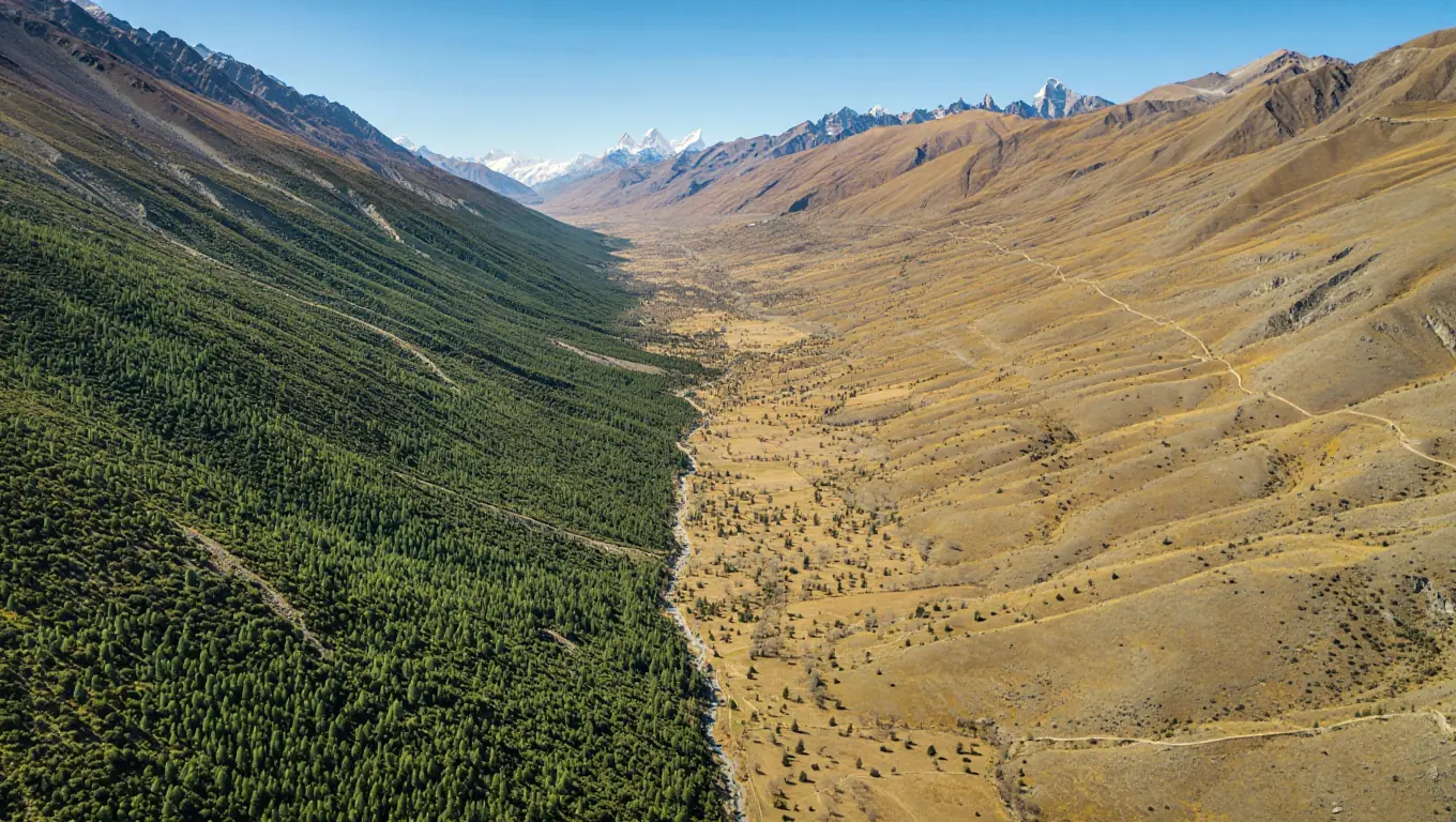
Pinpointing the exact Mount Everest location is critical for understanding the weather systems that batter its slopes. Situated in the Mahalangur Himal sub-range, the mountain sits at the border of Nepal and the Tibet Autonomous Region of China. This specific spot acts as a massive meteorological barrier. To the south, the humid monsoon winds from the Bay of Bengal slam into the range, dumping massive amounts of snow. To the north, the Tibetan Plateau remains arid and wind-scoured.
The Mount Everest location is defined by extreme vertical relief. It is not an isolated cone but part of a massive horseshoe of peaks that includes Lhotse and Nuptse. Understanding the terrain requires identifying the specific zones that guard the summit:
- The Khumbu Glacier: This river of ice flows from the Western Cwm. It creates the infamous Khumbu Icefall, a chaotic jumble of house-sized ice blocks that shift daily.
- The Western Cwm: Often called the “Valley of Silence,” this bowl-shaped valley concentrates solar radiation, making it surprisingly hot during the day, sometimes scorching climbers in their down suits.
- The South Col: A desolate, wind-swept pass between Everest and Lhotse. It serves as the final launching pad for summit bids on the Nepal side.
- The Kangshung Face: The eastern wall of the mountain. It is a sheer drop of over 3,000 meters, hanging with unstable glaciers, making it one of the most dangerous and rarely attempted routes in history.
According to the study “Mt. Everest’s highest glacier is a sentinel for accelerating ice loss” (2022, University of Maine), researchers estimate that once South Col Glacier ice is regularly exposed, roughly ~55 meters (about 180 feet) water-equivalent thinning could occur in about ~25 years—over 80 times faster than the millennia it took that ice to form—underscoring how quickly Everest’s highest-elevation ice can shift under warming conditions.
The Himalaya didn’t “appear” fully formed—it’s still being built as India continues to collide with Asia. A good explainer connects plate motion to uplift and helps make sense of why this landscape remains geologically restless today.
The Tectonic Reality
The Mount Everest map coordinates (27°59′17″N 86°55′31″E) place the summit directly on a fault line. This geological instability creates unique hazards. Earthquakes, like the devastating one in 2015, can trigger massive avalanches from the ridges above Base Camp. Travelers studying the Mount Everest map will notice that the approach is not a straight line; it is a zig-zag path designed to avoid the most active fall zones. The surrounding giants, while slightly lower, create wind tunnels that can accelerate storms to hurricane speeds in minutes.
Mount Everest Peak: The Highest Point on Earth
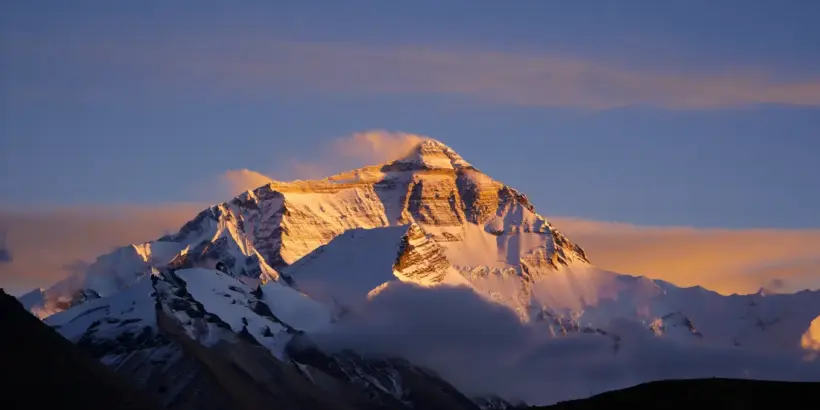
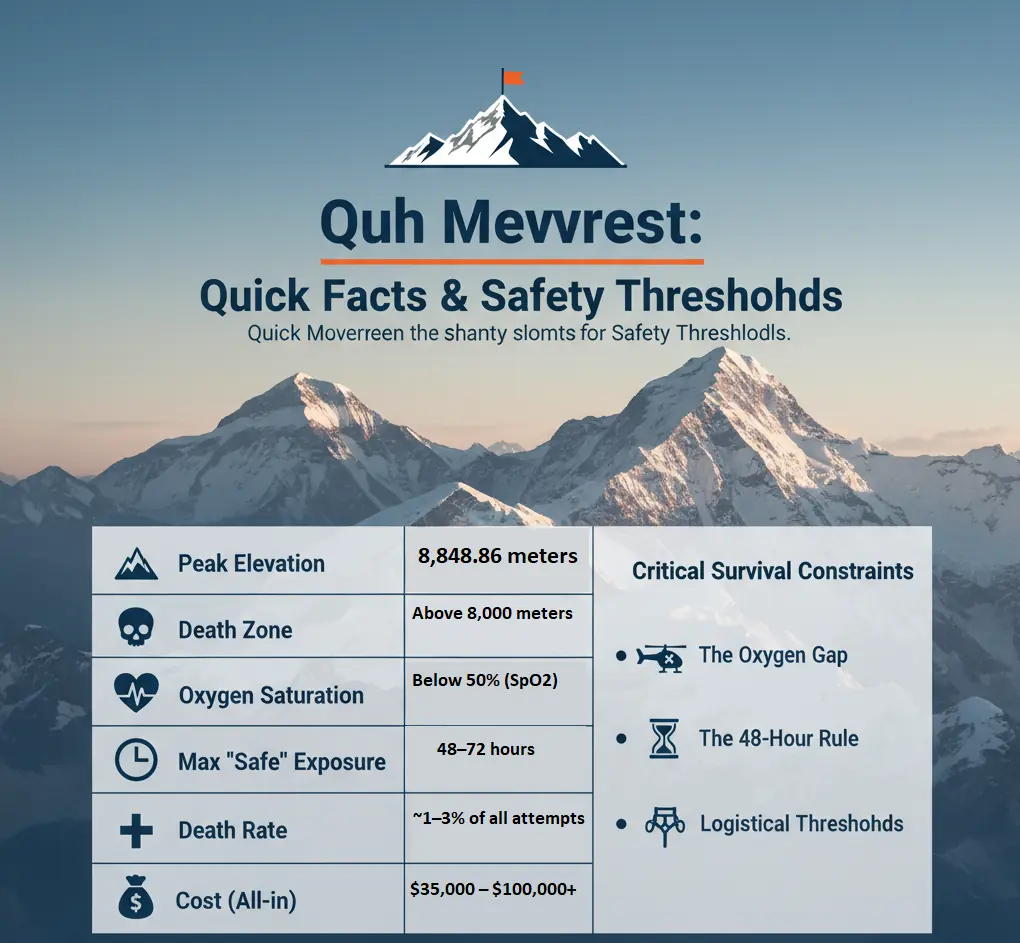
The Mount Everest peak stands at exactly 8,848.86 meters (29,031.7 feet), a height officially ratified by Nepal and China in 2020 after years of varying measurements. This specific number is significant because it sits right at the edge of the stratosphere. At the Mount Everest peak, atmospheric pressure drops to about 33% of what it is at sea level. This means every breath you take delivers only a third of the oxygen your body is used to.
The Death Zone Physiology
Above 8,000 meters, human physiology enters a terminal catabolic state. In this zone, the body exhausts glycogen stores and begins rapid muscle atrophy within 48 to 72 hours; failure to descend within this window typically results in pulmonary or cerebral edema regardless of initial fitness. In this zone, the human body cannot acclimatize. It begins to consume its own muscle tissue for energy, and digestive systems shut down.
The mountain does not care about your fitness level; above 8,000 meters, survival is a race against your own deteriorating biology, making efficiency more valuable than raw strength.
Even with supplemental oxygen, the body is under immense stress. Thinking becomes slow, and simple tasks like clipping a carabiner can feel like advanced calculus. This hypoxia is the primary reason why mistakes happen near the Mount Everest peak.
Mount Everest Map: Key Landmarks and Features
A detailed Mount Everest map reveals the logistical chain required to get a human to the top. It highlights the string of camps that act as stepping stones.
Reading the Route
When examining a Mount Everest map, you must distinguish between the two main highways.
- South Side (Nepal): The route goes through the Khumbu Icefall to Camp 1, then the Western Cwm to Camp 2 (Advanced Base Camp), up the Lhotse Face to Camp 3, and finally to the South Col (Camp 4).
- North Side (Tibet): The route starts at the Rongbuk Glacier, moves to an Advanced Base Camp that is much higher than on the south side, climbs to the North Col, and follows the ridge.
Looking closely at the Mount Everest map, one notices the “Balcony” and the “Hillary Step” on the south side. These are bottlenecks. In recent years, photos of climber traffic jams have gone viral; these occur at these specific narrow points where passing is difficult. Understanding the Mount Everest map is essential for strategy—knowing where you can rest and where you must keep moving is a matter of life and death.
Mount Everest: Which Country Does It Belong To?
Sovereignty over the mountain is often misunderstood by the general public. The question regarding Mount Everest which country holds jurisdiction is answered by a border line that runs precisely across the summit point. The northern slope belongs to China (Tibet), and the southern slope belongs to Nepal. This division creates two completely different climbing cultures, regulatory environments, and experiences.
Nepal’s Claim to Mount Everest
To the south, the mountain is revered as Sagarmatha, meaning “Goddess of the Sky.” The Nepali side is the heart of the commercial trekking industry. When people ask regarding Mount Everest which country sees the most tourism, the answer is overwhelmingly Nepal. The infrastructure here is highly developed, with a network of lodges (teahouses) stretching from Lukla to Gorak Shep.
- Access: Most visitors fly into the perilous Tenzing-Hillary Airport in Lukla.
- Culture: The route passes through Sherpa villages like Namche Bazaar and Tengboche, offering deep cultural immersion.
- Permits: The Nepali government issues a high number of permits, which generates significant revenue but also leads to crowding.
- Rescue: A robust, albeit expensive, helicopter rescue industry operates here, capable of plucking climbers from as high as Camp 2.
Step-by-Step: Identifying the Nepali Side
If you are looking at images or planning a trip and want to know regarding Mount Everest which country you are seeing, look for these visual cues:
- Greenery: If the approach involves walking through pine forests and rhododendrons before hitting the snow, it is Nepal.
- The Icefall: If the route requires navigating a chaotic, flowing river of ice blocks immediately above Base Camp, that is the South Face.
- The Angle: The view from Kala Patthar (the famous viewpoint) shows the black rocky triangle of the summit peeking out behind the Nuptse ridge.
Tibet’s Connection to Mount Everest
On the northern side, the mountain is known as Chomolungma, or “Mother Goddess of the World.” When discussing Mount Everest which country allows for easier physical access to the mountain’s base, the answer is China. A paved road leads all the way to the North Base Camp, allowing tourists to drive up in buses rather than hike for a week.
Administrative Differences
The query regarding Mount Everest which country is stricter usually points to China. The Chinese government regulates expeditions tightly. They have been known to close the mountain entirely for climbing seasons with little notice due to political reasons or cleanup efforts. The permit fees are generally similar, but the logistical requirements differ. On the north side, yaks are often used to carry gear to Advanced Base Camp, which sits at a staggering 6,400 meters—higher than most mountains in North America.
International Recognition and Disputes
While the Mount Everest location is geographically fixed, the politics surrounding it are fluid. Historically, the exact height was a matter of debate between the two nations until the joint announcement in 2020 settled the matter. Today, diplomacy concerning Mount Everest which country manages the summit is largely cooperative, but the rules are distinct.
For example, a climber cannot simply traverse the mountain. Descending into Tibet after summiting from Nepal without a pre-arranged visa and permit is illegal and has led to international incidents.
- Rescue Disparity: One critical difference regarding Mount Everest which country you choose is safety nets. In Tibet, helicopters are generally not allowed to fly rescue missions near the mountain. If you get into trouble on the North Ridge, your teammates must carry you down. There is no air support.
- Visual Differences: The North Face is a massive, clean sweep of rock and ice that is visible in its entirety from the Rongbuk Monastery. It offers a more “complete” view of the mountain from the base compared to the obstructed views from the south.
Climbing Mount Everest
Reaching the top is not a weekend activity; it is a logistical masterpiece involving tons of equipment and weeks of patience. It is a siege-style operation where teams establish a series of camps higher and higher, slowly pushing their bodies to adapt.
Historical Ascents and Notable Climbers
The history of the Mount Everest peak is a timeline of human ambition. The early British expeditions in the 1920s approached from Tibet because Nepal was closed to foreigners. George Mallory and Andrew Irvine disappeared high on the North Ridge in 1924, leaving behind the enduring mystery of whether they reached the top before dying.
It wasn’t until 1953 that Edmund Hillary, a beekeeper from New Zealand, and Tenzing Norgay, a Sherpa guide, officially reached the summit from the Nepal side. This opened the floodgates.
In 1978, Reinhold Messner and Peter Habeler did the unthinkable: they climbed the Mount Everest peak without supplemental oxygen. Doctors predicted they would suffer permanent brain damage, but they returned safely, proving that the human body is capable of more than science believed.
In 1980, Messner returned to do it again—solo, from the Tibet side, during the monsoon. This remains one of the greatest feats in mountaineering history.
Technical Difficulty
While not a technical rock-climbing objective in the traditional sense, the Everest summit push is officially graded at Alpine AD (Assez Difficile). This rating indicates a demanding high-altitude ascent. Climbers must be inherently proficient in advanced crampon technique on 45-degree ice and possess the stamina for sustained fixed-line ascents. Mastery of these skills is non-negotiable to avoid physical exhaustion and to minimize time spent in bottleneck zones, such as the Hillary Step.
Challenges and Risks of Climbing
The Mount Everest map is dotted with hazard zones. The primary killers are avalanches, falls, and altitude sickness (HAPE and HACE).
High Altitude Pulmonary Edema (HAPE)
This occurs when blood vessels in the lungs leak fluid, essentially drowning the climber in their own plasma. It can strike anyone, regardless of fitness. The only cure is immediate descent.
Statistically, the South Col route carries a higher risk of avalanche-related fatalities due to the Khumbu Icefall, while the North Ridge route presents a 30% higher risk of cold-weather injuries due to extreme wind exposure and isolation from immediate medical support
Comparison of Major Routes
To help understand the logistical differences, here is a comparison of the two main commercial highways.
| Feature | South Col Route (Nepal) | North Col Route (Tibet/China) |
| Primary Hazard | Khumbu Icefall (Avalanche/Collapse) | High Winds & Extreme Cold |
| Access to Base Camp | 10-14 day Trek | Drive-in (Paved road) |
| Rescue Availability | Helicopter rescue possible below C2 | No helicopters; manual rescue only |
| Crowds | High traffic, potential bottlenecks | Generally fewer teams |
| Campsite Comfort | Ice/Glacier camping | Rocky/Gravel camping |
This comparison highlights that while Nepal offers better rescue options, it exposes climbers to the unpredictable Icefall, whereas the Tibet side is technically safer from avalanches but harsher in terms of weather and isolation.
Preparation and Training for the Expedition
Preparing for the Mount Everest location requires years, not months. A climber must be comfortable on 6,000 and 7,000-meter peaks before even considering the big one.
A 12-Month Training Cycle
Training is not just about running. It involves specific periodization:
- Base Phase (Months 1-4): Low intensity, high volume. Hiking with a heavy pack for 6-8 hours to build capillary density.
- Strength Phase (Months 5-8): Gym work focused on legs and core. Squats, lunges, and step-ups with weight.
- Power Endurance (Months 9-11): High-intensity interval training (HIIT) to improve the body’s ability to process oxygen under stress.
- Taper (Month 12): Rest and recovery before flying to Kathmandu.
Mental Resilience
You can train your legs to carry 50 pounds, but training your mind to handle the suffocating fear at the Mount Everest peak is different. Climbers must simulate suffering—cold showers, long days with low calories, and high-stress decision-making.
Success on the mountain is 40% physical conditioning and 60% psychological resilience; if you panic when the oxygen tank hisses, your physical strength becomes irrelevant.
Ecological and Environmental Aspects
The majesty of the Mount Everest location is under threat. The mountain has been dubbed the “world’s highest garbage dump,” a title that cuts against the romanticized image of the Himalayas.
Flora and Fauna of Mount Everest
Lower elevations of the Mount Everest location, particularly within the Sagarmatha National Park, are rich in biodiversity. The pine and hemlock forests shelter musk deer, Himalayan tahrs, and the elusive snow leopard. The national bird of Nepal, the Danphe (Himalayan Monal), with its iridescent feathers, is often seen near villages.
However, as one ascends toward the Mount Everest peak, life vanishes. The tree line ends around 4,000 meters. Above 5,000 meters, only mosses and lichens survive. Interestingly, a small black jumping spider (Euophrys omnisuperstes) has been found as high as 6,700 meters, feeding on stray insects blown up by the wind. Beyond that, the mountain is a sterile zone of rock and ice.
Environmental Impact of Tourism
Every year, thousands of trekkers descend on the Mount Everest map region. They bring money, but they also bring plastic, batteries, and biological waste.
- The Waste Crisis: Human waste at high camps does not decompose. It freezes and accumulates. It is estimated that thousands of kilograms of human excrement are left on the mountain each season, polluting the glaciers that feed the rivers below.
- Glacial Melt: As the global climate warms, the glaciers identified on the Mount Everest map are receding. This melting ice is exposing old trash, discarded oxygen bottles from the 70s, and even the bodies of fallen climbers that were previously buried.
“It would be better for the mountain to reduce the number of climbers.” — Kanchha Sherpa, member of the 1953 Mount Everest expedition team and the last surviving member of that first successful summit expedition (interviewed by The Associated Press).
Conservation Efforts and Challenges
Governments are now asking Mount Everest which country is doing more for conservation? Nepal has implemented a deposit scheme where expeditions must pay a deposit that is only refunded if they bring their trash back down. The Sagarmatha Pollution Control Committee (SPCC) manages the “Icefall Doctors” and monitors waste at Base Camp.
On the north side, China has taken drastic measures, occasionally closing the mountain to tourists to conduct massive cleanup operations, removing tons of debris from the high camps.
Checklist: Being an Eco-Friendly Trekker
If you visit the region, adhere to these strict rules:
- Carry in, Carry out: Every candy wrapper you bring must leave with you.
- Use Water Purification: Avoid buying plastic bottled water. Use iodine tablets or a UV filter.
- Stick to Trails: Widening trails destroys fragile alpine vegetation that takes decades to grow back.
- Respect Wildlife: Do not feed or approach animals, no matter how tame they seem.
Practical Steps for Travelers
- Bring a reusable bag: Dedicate one pocket of your pack for your own trash.
- Buy local food: Imported packaged goods create more waste than Dal Bhat (lentils and rice), which is cooked in bulk.
- Choose sustainable operators: Ask tour companies about their porter policies and waste management before booking.
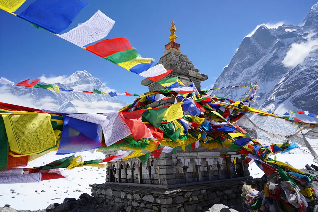
Cultural Significance of Mount Everest
The mountain is not just a pile of geology; it is a living deity. The name Chomolungma predates the British name Everest by centuries.
Mount Everest in Local Mythology
For the Sherpa people living in the shadow of the Mount Everest peak, the mountain is the abode of Miyolangsangma, the goddess of inexhaustible giving. She rides a tiger and is one of the five sisters of long life. Climbing the mountain is not seen as a sport or a conquest; it is a trespass into a sacred realm that requires absolution and permission.
The Puja Ceremony
Before any expedition sets foot on the ice, a Puja ceremony is held at Base Camp. A Buddhist Lama constructs an altar, chants mantras, and blesses the climbing gear—crampons, axes, and boots. Rice and flour are thrown into the air to appease the spirits. Westerners often view this as a quaint tradition, but for the Sherpas, it is the most critical part of safety. They will not climb without it.
Impact on Local Communities
The economy of the Khumbu region relies heavily on the answer to Mount Everest which country tourists choose to visit. The influx of wealth has transformed Sherpa life. It has built schools, hospitals, and hydroelectric plants. Many Sherpas have become wealthy business owners, running lodges and expedition companies.
However, this has come at a cost. Traditional farming practices are being abandoned. Young men are drawn to the dangerous high-altitude work because it pays ten times the average national salary, leading to a disproportionate number of deaths in the community.
Table: Cultural Perspectives
| Aspect | Western/Foreign Perspective | Sherpa/Local Perspective |
| The Summit | A conquest, a tick-list item, a personal challenge. | A sacred place to be respected; a place of work. |
| Risk | Adrenaline, “finding oneself,” pushing limits. | Occupational hazard; a means to support family. |
| The Name | Mount Everest (named after a British Surveyor). | Chomolungma or Sagarmatha (Ancient Deities). |
| Motivation | Glory, fame, personal achievement. | Livelihood, duty, spiritual connection. |
This comparison illustrates the fundamental disconnect that often exists between the paying client and the working guide, necessitating a deeper level of respect from visitors.
Mount Everest in Popular Culture
The Mount Everest map is etched into pop culture via movies like Everest (2015) and books like Into Thin Air. These portrayals often dramatize the danger, focusing on the Mount Everest peak tragedies rather than the daily life of the region. They create a narrative of “man vs. nature,” whereas the local view is more about “man living with nature.”
Always remember that the Sherpa people are the hosts, and the mountain is their home; treat the culture with the same reverence you accord the dangerous slopes.
Planning a Visit to Mount Everest
You don’t have to be an elite mountaineer to experience the majesty of the Mount Everest location. Trekking to Base Camp is achievable for most fit hikers and offers a front-row seat to the spectacle.
Best Time to Visit Mount Everest
Timing is everything. The weather at the Mount Everest peak dictates the schedule for the entire region. There are two main windows.
- Pre-Monsoon (Late April – May): This is the primary climbing window. The Mount Everest peak is most accessible because the jet stream winds lift slightly. Base Camp is a bustling city of yellow tents. The trails are busy, and the energy is high.
- Post-Monsoon (Late September – November): The air is cleaner, and the skies are crystal clear. The views of the Mount Everest peak are generally better than in spring because there is less haze. However, it is colder, and there are no expedition teams at Base Camp, so the “city” is gone.
Seasonal Nuances
Travelers often look at a Mount Everest map and assume weather is consistent. It is not. Winter (December-February) is brutally cold, and many lodges close. Monsoon (June-August) brings rain, leeches, and clouds that obscure the mountains completely.
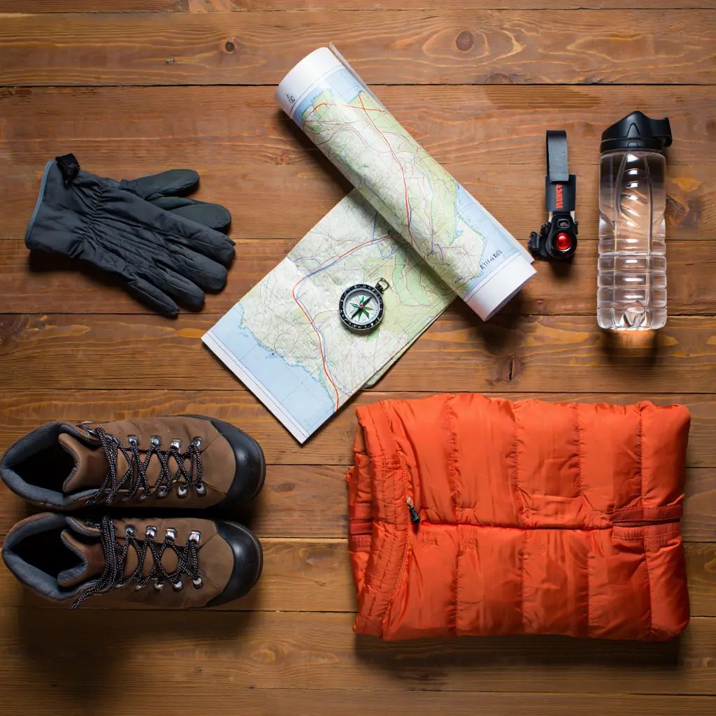
Travel Tips and Essential Gear
Packing for the Mount Everest location requires a system of layering. You will experience temperatures from +20°C in the sun to -15°C at night.
Step-by-Step: Packing for Base Camp Trek
- Base Layer: High-quality merino wool (top and bottom). Do not use cotton; it kills by trapping moisture.
- Insulation: A down jacket rated for -10°C to -20°C. This is your lifeline in the evenings.
- Shell: A windproof and waterproof hard shell jacket to protect against sudden storms.
- Footwear: Broken-in hiking boots with ankle support. Blisters are the number one reason people quit the trek.
- Hydration: Two 1-liter water bottles. Wide-mouth bottles are better because the narrow necks of standard bottles can freeze shut.
Guided Tours and Trekking Options
When deciding between Mount Everest which country to visit for trekking, Nepal is the standard for hikers. The “Everest Base Camp Trek” is a classic 12-14 day round trip starting from Lukla.
If you’ve never trekked at altitude, it’s hard to visualize how the days actually unfold—pace, terrain, and what “comfort” looks like in teahouses along the route. This short film gives a grounded feel for the rhythm of the trek and the on-the-ground logistics.
Choosing an Operator
When researching tours, look beyond the price tag. Verify their safety record. A cheap tour often cuts costs on porter wages or emergency oxygen. Ensure your guide knows the Mount Everest map intimately, carries a satellite phone, and has a pulse oximeter to check your oxygen saturation daily.
Understanding the Financial Commitment
Many climbers underestimate the sheer logistical weight of an Everest expedition. The cost of $35,000 to $100,000+ is not merely a “tour fee”; it is a complex budget covering high-altitude infrastructure, specialized rescue support, and international logistics. Transparency in these costs is vital for selecting an ethical and safe operator.
Expedition Cost Breakdown
| Cost Category | Estimated Range (USD) | Description |
| Government Permits | $11,000 – $15,000 | Mandatory peak fees charged by Nepal or China. |
| High-Altitude Oxygen | $3,000 – $6,000 | 5–7 bottles, plus regulators and masks. |
| Sherpa/Staff Support | $5,000 – $12,000 | Wages, insurance, and gear for your support team. |
| Logistics & Food | $10,000 – $20,000 | Base Camp infrastructure, local transport, and meals. |
| Gear & Insurance | $5,000 – $15,000 | Specialized kit, evacuation insurance, and travel. |
| Operator Fee | $10,000 – $40,000 | Profit margin, marketing, and company overhead. |
Note on Budgeting: A budget below $35,000 is a significant red flag. It often indicates that the operator is cutting costs on oxygen reserves, backup rescue funding, or, most critically, the fair wages and safety equipment provided to Sherpa guides. When selecting an expedition company, always verify that your insurance policy explicitly covers emergency heli-evacuation up to 7,000 meters.
FAQ
How much does it actually cost to climb Mount Everest?
The price varies wildly depending on the level of service. A budget expedition might cost around $35,000, offering bare-bones support. A fully guided, luxury western service can exceed $100,000. This fee covers the $11,000 permit for Nepal, oxygen bottles (which cost hundreds each), Sherpa support, high-altitude food, and base camp logistics.
Can I see Mount Everest without trekking for weeks?
Yes, you can. You can take a “mountain flight” from Kathmandu. These small planes fly past the Mount Everest peak early in the morning, giving you a close-up view without any physical effort. Alternatively, on the Tibet side (China), you can drive all the way to the Rongbuk Monastery, which offers a clear view of the North Face.
Is it possible to climb Mount Everest alone?
Technically, “solo” climbs have been done in history, but they are incredibly rare and suicidal for most. Strictly speaking, the Nepali government has banned “solo” climbers without a guide to reduce accidents. You must have at least a support staff or liaison officer, so true solitude is largely a thing of the past.
What happens to the bodies of climbers who die?
Recovering bodies from the high altitude is often impossible due to the extreme risk it poses to the rescue team. A frozen body can weigh over 300 pounds. Therefore, many bodies remain on the mountain, becoming grim landmarks. Occasionally, families will pay for a recovery mission, but it is expensive and dangerous.
Do I need to use oxygen to trek to Base Camp?
No, trekkers to Base Camp (5,364 meters) generally do not use supplemental oxygen. The trek is designed with “acclimatization days” (usually in Namche and Dingboche) to allow the body to adjust naturally. Oxygen is usually only reserved for climbers going above Camp 3 or for emergency medical treatment during the trek.
Conclusion
Mount Everest remains one of the most compelling places on Earth, a point where geology, meteorology, and human willpower collide in a spectacular and dangerous fashion. Whether you are painstakingly analyzing the Mount Everest map for a future expedition, curious about Mount Everest which country manages the northern slopes, or simply fascinated by the staggering height of the Mount Everest peak, the mountain commands respect. It is a place of undeniable beauty, but also a place of strict physical laws that cannot be negotiated.
If you are considering a visit, start by honestly assessing your physical fitness and researching ethical tour operators who support the local economy. Don’t just dream about the Mount Everest location; start hiking your local trails with a weighted pack, break in your boots, and read up on high-altitude health. The mountain will be there, waiting for those who are prepared to meet it on its own terms.
To help you get ready for the adventure of a lifetime, I’ve put together a comprehensive preparation document. This isn’t just a simple list; it covers gear specifics, physical benchmarks you should hit before booking, and insurance nuances you might overlook.

Do you believe the mountain should be restricted to professional climbers only to save the environment, or should it remain open to anyone brave enough to try? Drop a comment below to share your opinion!
Sources
- Mt. Everest’s highest glacier is a sentinel for accelerating ice loss — Potocki et al., 2022, npj Climate and Atmospheric Science (University of Maine–led research).
- Sherpa, K., 2024, Last surviving member of the first team to conquer Mount Everest says it is crowded and dirty now — AP News (The Associated Press).