Pinpointing the exact spot of the world’s highest peak seems like it should be simple geography, but the Mt Everest location is actually a complex mix of politics, geology, and history. Most people can point to the Himalayas on a globe, yet few understand the intricate border dynamics or the specific coordinates that define this massive summit. Misunderstanding exactly where the mountain sits can lead to confusion about climbing permits, cultural heritage, and even which side of the massif offers the best views for trekkers. By the time you finish reading, you will possess a cartographer’s grasp of the region and the practical knowledge needed to plan a trip or simply win your next trivia night.
- Exact Location: Mahalangur Himal sub-range, Himalayas.
- Political Border: 27°59′17″N (Nepal) / 86°55′31″E (China/Tibet).
- Official Height: 8,848.86 m (fixed 2020).
- Time Zone: NPT (UTC+5:45) / CST (UTC+8).
Where is Mt Everest Located?
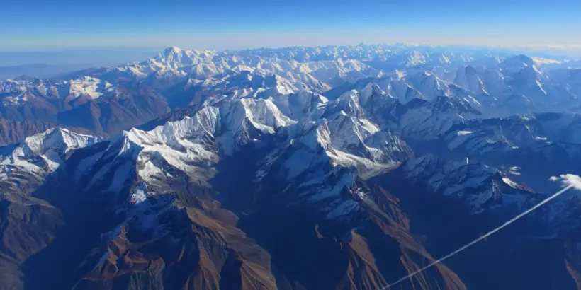
The roof of the world doesn’t sit in isolation; it anchors a massive range that defines the geography of South Asia. To truly grasp the scale, one must look beyond simple borders and understand the peak’s position relative to the tectonic plates colliding beneath it. This section breaks down the hard numbers and the surrounding giants that make this area so unique.
Geographical Coordinates of Mt Everest
Precise navigation relies on numbers, not just names. The summit sits exactly at 27°59′17″N latitude and 86°55′31″E longitude. These coordinates place it squarely in the Mahalangur Himal sub-range of the Himalayas.
Why does this matter? For modern adventurers using GPS, these digits are the difference between standing on the true summit and hovering on a false peak. It is a precise point on the globe where the Indian and Eurasian tectonic plates continue to smash into one another, pushing the land upward.
In December 2020, Nepal and China jointly certified Mount Everest’s official elevation as 8,848.86 meters (29,031.69 feet), a GPS-backed remeasurement that underscores why the peak is periodically rechecked as tectonic uplift and major earthquakes can subtly alter the massif over time (2020, Nepal Department of Survey & China’s national surveying authorities).
Understanding the Grid
When you look at these coordinates, you are seeing the result of millions of years of geological pressure. The latitude results in a UV Index exceeding 15+; combined with an 80% snow albedo, this creates a high-risk environment for retinal burns and second-degree solar dermatitis within 12 minutes.
Elevation and Prominence
The official elevation is currently recognized as 8,848.86 meters (29,031.7 feet). The 8,848.86 m height (established 2020) utilizes the Global Geoid Model, accounting for a 4mm annual tectonic shift northeast and resolving the ‘rock vs. snow’ height disparity. However, vertical stature is just one part of the story; prominence—the height of a mountain relative to the lowest contour line surrounding it—is what makes Everest truly stand out.
- Total Elevation: 8,848.86 meters
- Prominence: 8,848.86 meters (since it is the parent peak of all land)
- Rock Height: Slightly lower than the snow height
- Snow Cap: Varies seasonally by several feet
Jon Krakauer, journalist and bestselling nonfiction author (known for reporting on high-risk expeditions), wrote in Into Thin Air (1997): “Everest has always been a magnet for kooks, publicity seekers, hopeless romantics, and others with a shaky hold on reality.”
This emphasizes that the mountain’s sheer height draws people regardless of exactly where the borders lie.
Surrounding Mountain Ranges
Everest has famous neighbors. It is flanked by Lhotse (the fourth highest mountain) to the south, Nuptse to the southwest, and Makalu to the southeast. These giants form a cluster that makes the Mt Everest location one of the most vertical places on Earth.
The Mahalangur Himal
This specific sub-range is the crown jewel of the Himalayas. It acts as a massive barrier intercepting the monsoon clouds, creating distinct climate zones on either side.
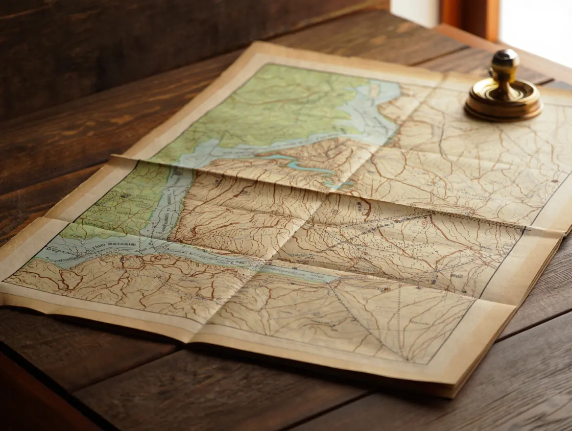
Mt Everest Location Map
Visualizing the terrain is crucial because a standard road chart is useless in this vertical world. A proper Mt Everest location map reveals the glaciers, the steep ridges, and the treacherous passes that define the area.
How to Read the Mt Everest Location Map
Reading a topographic chart of this region requires a different mindset than scanning a city layout. You aren’t looking for roads; you are looking for contour lines that indicate survivability.
Common Mistakes When Reading Topo Charts:
- Ignoring Contour Intervals: Failing to realize that lines close together mean a vertical cliff, not a steep hill.
- Misinterpreting Glacial Zones: Assuming white space is flat snow when it is often a crevasse-filled icefall.
- Scale Confusion: Underestimating travel time; 5 miles on a chart here can take two days to walk.
- North Orientation: Forgetting that magnetic north varies, which is critical for compass navigation.
Understanding Contour Lines
On a high-quality Mt Everest location map, the contour lines are incredibly dense. The closer the ink markings, the steeper the terrain. If you see lines touching, you are looking at a sheer face, like the Kangshung Face.
Key Landmarks and Features on the Map
When you scan a Mt Everest location map, your eyes should immediately dart to specific landmarks that dictate travel. The Khumbu Icefall is the gateway on the south side, a shifting river of ice that is the most dangerous part of the climb.
Critical Landmarks:
- Base Camp (South): The tent city in Nepal.
- The Hillary Step: The famous rock face near the summit (though physically altered by the 2015 earthquake).
- The South Col: The windswept pass between Everest and Lhotse.
Interpreting the Ridge Lines
The ridges are the highways to the top. The Southeast Ridge is the standard route from Nepal, clearly visible on any detailed Mt Everest location map.
Interactive Tools for Viewing Mt Everest
Technology has changed how we see the mountain. You no longer need to buy paper charts to understand the terrain.
Step-by-Step Guide to Using Google Earth for Everest
To really get a feel for the topography without leaving your chair, follow this method:
- Download and Launch: Open Google Earth Pro for the most detailed terrain data.
- Enter Coordinates: Type “27°59′17″N 86°55′31″E” into the search bar.
- Tilt the View: Hold the shift key and drag your mouse to tilt the perspective. This turns the flat image into a 3D model, showing the sheer drop of the faces.
- Layer Toggle: Turn on the “Terrain” layer to see the actual elevation bumps.
- Trace the Route: Follow the Khumbu Glacier up to the Western Cwm to visualize the climber’s path.
The map is not the territory, but a good map is the difference between an adventure and a rescue mission.
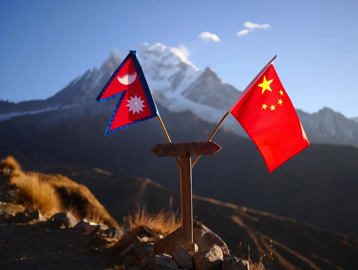
Mount Everest in Which Country?
This is the most common question asked by beginners. The answer is not a single nation, but a shared custody that dictates everything from politics to climbing fees. Asking “Mount Everest in which country” usually leads to a discussion about the border between Nepal and China.
Nepal’s Role in Housing Mt Everest
The southern face of the mountain lies in Nepal. For most of the world, Nepal is synonymous with Everest. The culture of the Sherpa people, the teahouses, and the famous trek to Base Camp all happen here.
- Access: Through Kathmandu and Lukla.
- Culture: Deeply Buddhist, Sherpa dominated.
- Vibe: Bustling, commercial, slightly chaotic but friendly.
When people ask Mount Everest in which country offers the “classic” experience, Nepal is the usual answer because of the supporting tourism infrastructure.
China’s Claim Over Everest’s Northern Face
The northern face lies in the Tibet Autonomous Region of China. This side is colder, windier, and historically harder to access due to political restrictions. China’s infrastructure allows for heavy-vehicle logistics directly to the North Base Camp (5,150m), a stark contrast to the 10-day yak-supported trek required on the Nepal side.
When considering Mount Everest in which country is cheaper to climb from, the answer used to be China, but prices are equalizing. The experience is starkly different—less trekking, more driving.
Bilateral Agreements on Everest’s Management
Because the summit is the border, both nations have to cooperate.
| Feature | Nepal Side (South) | China Side (North) |
| Base Camp Access | Multi-day trek (flights + walking) | Paved road (drive-in access) |
| Climbing Difficulty | Technically easier, but dangerous Icefall | Technically harder, colder, windier |
| Permit Cost | Generally $11,000 (royalty only) | Includes more logistics in fee |
| Rescue Ops | Helicopter rescue available | Very limited helicopter access |
| Crowds | Very high traffic | Controlled, fewer climbers |
This comparison highlights that the question of Mount Everest in which country you should visit depends entirely on your physical ability and travel style. If you want to trek, go to Nepal. If you want to see the mountain without hiking for weeks, China offers road access.
Managing the Summit
The actual tip of the mountain is shared. Climbers from both sides meet at the top. Occasionally, political tensions flare, but generally, the geography forces cooperation.
Peer-reviewed satellite analysis of 79 glaciers around Mt. Everest found that ice loss has consistently accelerated since the early 1960s and that thinning is now occurring even above 6,000 meters—evidence that glacial retreat is reshaping both the Nepal and Tibet sides of the massif (2020, University of St Andrews and collaborators).
What Continent is Mount Everest In?
It might seem obvious to a geography buff, but “what continent is Mount Everest in” is a frequently searched query for students and travelers planning big trips. The answer is Asia, but the context of where in Asia matters significantly.
The Asian Continent: Home to the Himalayas
Asia is massive, but the collision zone that created Everest is specific to the interface between the Indian subcontinent and the rest of Eurasia. So, when answering what continent is Mount Everest in, you are really talking about the southern central portion of the landmass.
Tectonic Context
The Indian plate is still pushing north at about 5cm per year. This means the region is physically changing, and Everest is technically getting slightly higher (or shifting) over geological time.
Significance of the Himalayas in Asia
The Himalayas are the water tower of Asia. They feed the major rivers—the Ganges, Indus, Yangtze, and Mekong—that support billions of people. Knowing what continent is Mount Everest in helps you understand the hydro-politics of the region.
Mini-Checklist: Identifying the Everest Region
- Check the Latitude: Are you between 27° and 28° North?
- Check the Watershed: Do the rivers flow south to the Ganges or north to the Tsangpo?
- Check the Culture: Do you see prayer flags and Stupas (Tibetan Buddhism)?
- Check the Vegetation: Is the tree line disappearing around 4,000 meters?
Practical Recommendation
If you are planning a trip and people ask what continent is Mount Everest in, tell them it’s in the part of Asia that acts as the world’s climate controller. Use this knowledge to pack correctly—Asia is hot, but this sector requires down suits.
Cultural and Geographical Importance
The mountain is known as Sagarmatha in Nepal (Goddess of the Sky) and Chomolungma in Tibet (Mother Goddess of the World). This dual identity reflects the diversity of the continent.
If you don’t respect the local culture, you are just a tourist looking at a rock; understand the sanctity of the place to truly see the mountain.
When travelers realize what continent is Mount Everest in, they often group it with trips to India or China, but the Himalayan culture is distinct and stands apart from the lowlands of both nations.
Historical Perspectives on Mt Everest’s Location
The Mt Everest location wasn’t always a pin on a digital map. For centuries, it was a blank spot, a rumor, or a miscalculated peak designated as “Peak XV.”
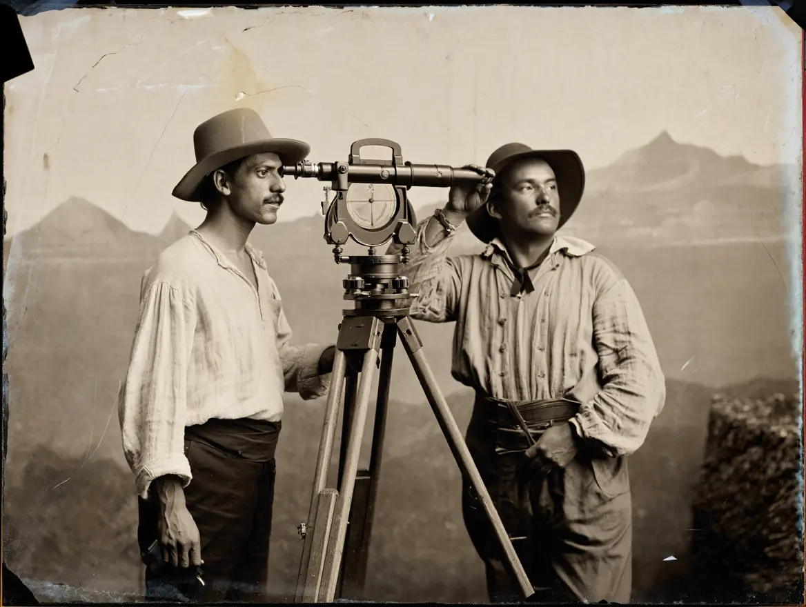
Early Explorations and Discoveries
In the mid-19th century, the Great Trigonometrical Survey of India sought to map the entire subcontinent. They used giant theodolites—weighing over 1,000 pounds—to measure peaks from hundreds of miles away because Nepal was closed to foreigners.
The Great Trigonometrical Survey is the backstory behind how “Peak XV” became Mount Everest—measured from a distance using triangulation, long before satellites. This video walks through the human and technical challenge of mapping a subcontinent with precision instruments in brutal field conditions. It’s the fastest way to make the history section feel real, not abstract.
Cartographic Representations Over Time
Early maps were fuzzy. The Mt Everest location drifted on paper as surveyors refined their calculations. It wasn’t until the mid-20th century that we had accurate charts of the approaches.
- 1850s: Identified as the highest peak.
- 1920s: First detailed plots of the northern approach by British expeditions.
- 1950s: First accurate diagrams of the southern approach (Nepal) opened up.
Role of Technology in Mapping Everest
Today, Lidar and satellite imagery give us millimeter precision. We no longer guess the Mt Everest location; we monitor it.
Modern GPS vs. Traditional Surveying
While satellites are great, ground-based GPS readings taken by climbers have refined the height. The 2020 joint announcement by Nepal and China was a result of this high-tech collaboration.
Interesting Facts About Mt Everest’s Location
The specific Mt Everest location creates phenomena that don’t exist anywhere else on the planet. It’s not just about being high; it’s about where it is high.
Unique Weather Patterns at Everest
The summit sits right in the jet stream. This is crucial. If the mountain were located 1,000 miles further south, it might be much easier to climb. Summit windows only open when the Jet Stream oscillates, dropping wind speeds below the 45 km/h safety threshold; speeds above 70 km/h induce frostbite on exposed skin in <15 minutes.
- The Weather Window: There are only a few days in May and sometimes October when the winds die down enough to summit.
- Temperature: It can drop to -60°C (-76°F).
Biodiversity and Ecosystems of the Region
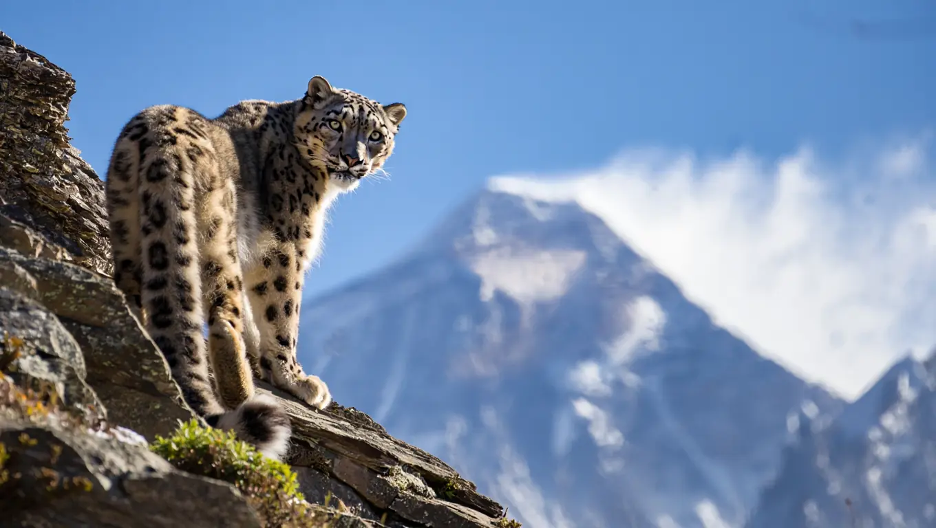
Despite the harshness, the lower slopes are teeming with life. The Mt Everest location in the Sagarmatha National Park protects snow leopards, Himalayan tahrs, and musk deer.
Nature doesn’t recognize borders; the snow leopard crosses between Nepal and China without a passport, and climbers would do well to adopt a similar respect for the land.
Cultural Significance to Local Communities
For the Sherpa people living in the shadow of the peak, the Mt Everest location is sacred ground. It is the abode of Miyolangsangma, the goddess of inexhaustible giving.
A peer-reviewed solid-waste management plan for Sagarmatha (Mt. Everest) National Park warns that rapidly rising tourism has outpaced local disposal capacity, increasing environmental and public-health risks in the Khumbu corridor (2020, INSTAAR at the University of Colorado Boulder).
Traveling to Mt Everest: What You Need to Know
Knowing the Mt Everest location is the first step; getting there is the adventure. This isn’t a trip you book on a whim.
Popular Routes to Mt Everest Base Camp
Most Americans choose the South Base Camp trek in Nepal. It combines accessibility with stunning scenery.
The Classic Route:
- Fly from Kathmandu to Lukla (the world’s most dangerous airport).
- Trek through Phakding and Namche Bazaar.
- Acclimatize at Tengboche Monastery.
- Push through Dingboche and Lobuche to Gorak Shep.
- Final hike to Base Camp.
Permits and Regulations for Visitors
You cannot just walk up. The bureaucracy is as steep as the mountain.
Required Paperwork (Nepal Side):
- TIMS Card (Trekkers’ Information Management System).
- Sagarmatha National Park Permit.
- Pasang Lhamu Rural Municipality Entrance Permit.
Modern environmental protocols now require a $4,000 refundable garbage deposit and the mandatory use of biodegradable waste bags (WAG bags) above Base Camp. These measures, enforced by the Sagarmatha Pollution Control Committee (SPCC), aim to mitigate the impact of the 200+ climber bottlenecks typically seen at the Hillary Step during peak 48-hour weather windows.
Safety Tips and Best Times to Visit
Seeing the trek on video helps you calibrate expectations: the pace, the dust, the altitude, and the daily routine in teahouses. This clip is specifically framed around acclimatization and safety habits—exactly what most first-timers underestimate. Pair it with your “Climb high, sleep low” line for maximum practical value.
Climb high, sleep low. It’s not just a catchy phrase; it is the physiological law that prevents your brain from swelling inside your skull.
Ed Viesturs, American high-altitude mountaineer and expedition guide (widely known for major Himalayan climbs), wrote during PBS’s NOVA “Alive on Everest” expedition Q&A (1997): “Getting to the top is optional. Getting down is mandatory.”
This mindset is essential when visiting such a remote location.
Timing Your Trip
- Pre-Monsoon (Feb-May): Busy, blooming rhododendrons, warmer.
- Post-Monsoon (Sept-Nov): Clearer skies, colder, less dust.
FAQ
Is Mt Everest located in India?
No, this is a common misconception. While India was responsible for the initial mapping (the Great Trigonometrical Survey), the mountain itself sits on the border of Nepal and China (Tibet). You cannot see Everest from most of India, though it is visible from some high points in Darjeeling on very clear days.
Can you see the Mt Everest location map on an iPhone?
Yes, standard apps like Apple Maps or Google Maps show the location clearly. However, for trekking, you should not rely on these. You need offline topographical programs like Gaia GPS or Maps.me, as cell service is spotty to non-existent once you go higher up the valley.
Does the location of Everest change?
Technically, yes. Because of the tectonic collision between India and Eurasia, the peak moves northeast roughly 4mm per year and grows slightly taller. However, for the purpose of your travel planning or chart reading, it is stationary.
What is the closest airport to Mt Everest?
On the Nepal side, the nearest functional terminal for trekkers is Tenzing-Hillary Airport in Lukla. It is a small STOL (Short Take-Off and Landing) strip. On the Chinese side, you can drive closer, but the closest major hub is in Lhasa, which is still a significant drive away.
Which side of the Mt Everest location is better for photography?
The North Face (Tibet) provides superior wide-angle panoramic visibility from 5,000m, whereas the South Side (Nepal) offers better environmental diversity for long-focal-length village photography.
Conclusion
Understanding the Mt Everest location is about more than just memorizing coordinates or pointing to a spot on a chart. It requires appreciating the deep geological forces that built the Himalayas, the complex political history between Nepal and China, and the vibrant cultures that thrive in the shadow of the peak. Whether you are looking at a Mt Everest location map to plan a dream trek or simply asking Mount Everest in which country to settle a debate, the answer reveals a world of connection and contrast.
If you are serious about visiting, start by studying the region virtually, but respect the physical reality of the altitude. Don’t just act like a tourist; prepare like an explorer. The mountain is beautiful, but it demands preparation and respect.

Would you like to take the next step in your planning? I have prepared a comprehensive checklist that covers gear, insurance nuances, and physical training benchmarks you need to hit before booking your flight.
Share your thoughts below: If you could only visit one side—the cultural trekking routes of Nepal or the drive-up massive vistas of Tibet—which would you choose and why?
Sources
- (2020, Nepal Department of Survey & China’s national surveying authorities) It’s official: Mount Everest is 8,848.86 metres tall
- (2020, Reuters) Mount Everest is higher than we thought, say Nepal and China
- (2020, University of St Andrews and collaborators) Six Decades of Glacier Mass Changes around Mt. Everest Are Revealed by Historical and Contemporary Images
- (2020, INSTAAR at the University of Colorado Boulder; International Mountain Society) A Sustainable Solid Waste Management Plan for Sagarmatha (Mt Everest) National Park and Buffer Zone, Nepal
- (Jon Krakauer, 1997, Into Thin Air: A Personal Account of the Mt. Everest Disaster) Into Thin Air
- (Ed Viesturs, 1997, PBS NOVA) NOVA Online | Alive on Everest | Climbing/Living