For decades, the exact elevation of the world’s tallest peak has been a subject of geological debate, political negotiation, and scientific curiosity. It is not just a static number on a map; the Mount Everest height represents a dynamic interplay of tectonic pressure and geological shifting that continues to surprise researchers. Whether you are a climber planning an expedition, a student of geography, or simply someone fascinated by Earth’s extremes, understanding the nuance behind these measurements is essential. This guide breaks down the complex history, the science of sea-level measurements, and why a few feet of difference matters more than you might think. By the end, you will understand exactly how this mountain measures up and how to interpret the data correctly.
Understanding Mount Everest’s Height
Most people memorize a single number in school and never think about it again, but the reality of the mountain’s elevation is far more fluid. For decades, the global benchmark stood at 8,848 meters (29,029 feet), a figure derived from a comprehensive Indian survey in the mid-20th century. The challenge lies not just in climbing the peak but in agreeing on where the top actually sits relative to the rest of the world.
Official Measurements of Mount Everest
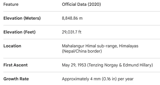
The accepted elevation has shifted multiple times over the last century, leading to confusion in textbooks and maps. However, different countries used different sea-level baselines. In late 2020, Nepal and China jointly announced a new, highly precise official figure: 8,848.86 meters (29,031.7 feet).
The 2020 Joint Announcement
This recent adjustment settled a long-standing discrepancy between the two nations. Previously, China measured the rock height, while Nepal included the snow cap. The new agreement accounts for the snow height, which is the surface a climber actually stands on.
When citing official data, always distinguish between “rock height” and “snow height,” as this variable accounts for a difference of nearly four meters in historical surveys.
Historical Changes in Measurement Techniques
The story of how we calculate the Mount Everest height is a timeline of technological evolution. In the mid-19th century, surveyors used heavy theodolites—giant telescope-like instruments—from over 100 miles away because they were not permitted to enter Nepal. They calculated the elevation using trigonometry, a feat of mathematics that resulted in a number shockingly close to modern GPS readings.
From Theodolites to Satellites
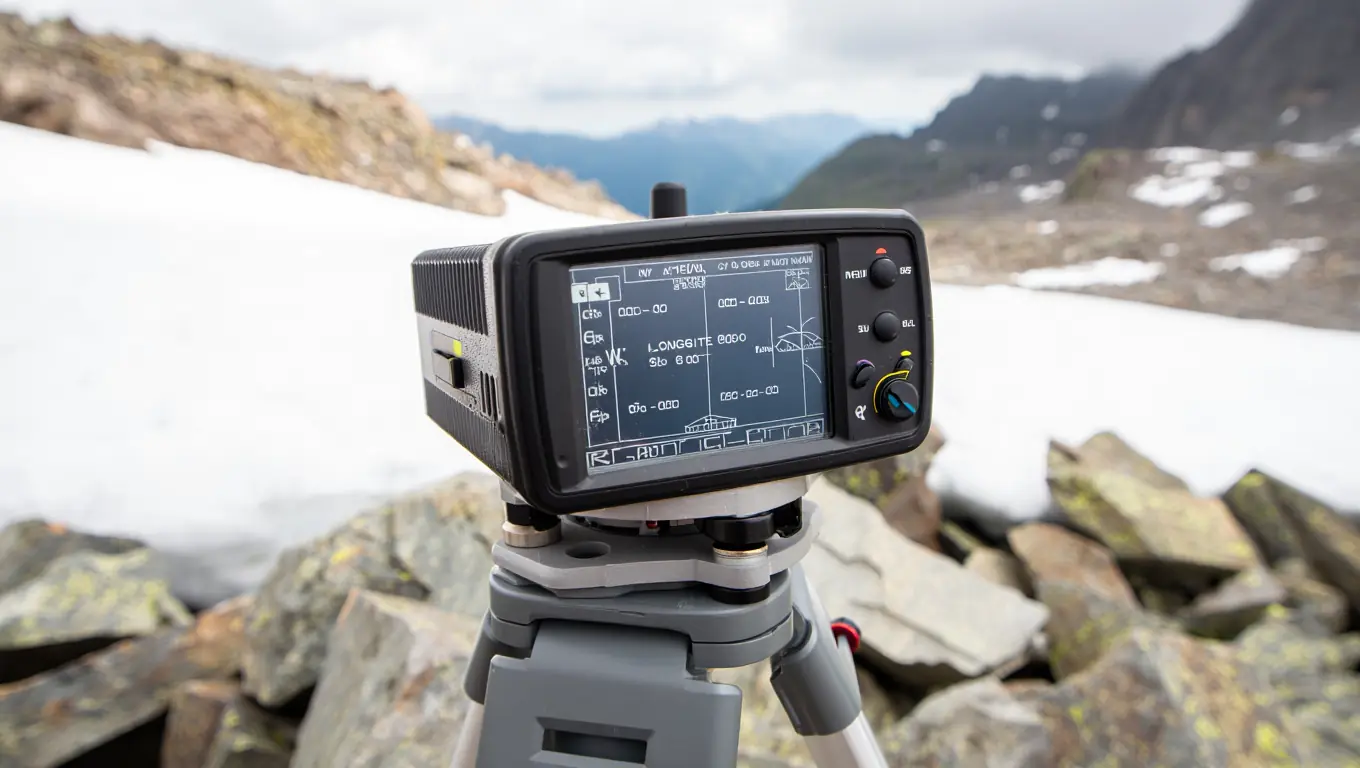
Modern surveyors utilize dual-frequency GNSS receivers capable of tracking GPS, GLONASS, and Galileo constellations simultaneously. During a summit window—which typically lasts only 20 to 60 minutes due to extreme weather—these devices must stay stationary to achieve sub-decimeter accuracy. They track signals from varying satellite constellations to pinpoint the location with sub-centimeter accuracy. Ground-penetrating radar is also used to measure the depth of the snow and ice sitting on top of the bedrock.
According to the peer-reviewed “Measurement of Height of Mt. Sagarmatha,” Nepal’s Survey Department combined summit GNSS observations with gravity surveying, precise leveling, and geoid computation to produce an updated orthometric height (the practical “above sea level” height) for Everest and reduce model- and atmosphere-related biases that complicated older optical surveys. (2021, Survey Department, Government of Nepal)
Challenges in Measuring Mount Everest
Measuring a mountain is not as simple as dropping a tape measure. The primary difficulty is gravity. The Earth is not a perfect sphere; it is an oblate spheroid with a lumpy gravitational field. This makes establishing “sea level” under a massive mountain range incredibly difficult.
Atmospheric Refraction
Light bends as it passes through the atmosphere. For early surveyors looking at the peak from the Indian plains, this bending of light made the mountain appear higher or lower depending on the time of day and air density. Modern equipment bypasses this, but gravity anomalies remain a hurdle.
Mount Everest Height: Different Units of Measurement
When discussing the mountain, context dictates the unit. Aviation authorities, climbers, and scientists all speak different “languages” regarding elevation. Confusion often arises when converting between metric and imperial systems without accounting for rounding errors.
Mount Everest Height in Meters
The scientific community and most of the world outside the United States rely on the Mount Everest height in meters. The current official figure is 8,848.86 meters. This unit is the standard for international cartography and climbing permits issued by the Nepalese government.
Why Meters Dominate Alpinism
- Standardization: Oxygen flow rates and camp elevations are almost always calculated using the Mount Everest height in meters.
- Base Camp: Located at approximately 5,364 meters.
- The Death Zone: Generally defined as altitudes above 8,000 meters.
We must look at how the Mount Everest height in meters has evolved over time to understand the precision we have today.
- 1856 Survey: The Great Trigonometrical Survey of 1856 originally estimated the peak’s elevation at approximately 8,840 meters.
- 1955 Survey: An Indian survey updated the Mount Everest height in meters to 8,848, which stood for decades.
- 1999 Survey: An American team proposed a Mount Everest height in meters of 8,850 using GPS.
- 2005 Survey: A 2005 Chinese expedition suggested the actual rock head sat at 8,844.43 meters, excluding the snow cap.
- 2020 Survey: The current joint announcement fixed the Mount Everest height in meters at 8,848.86.
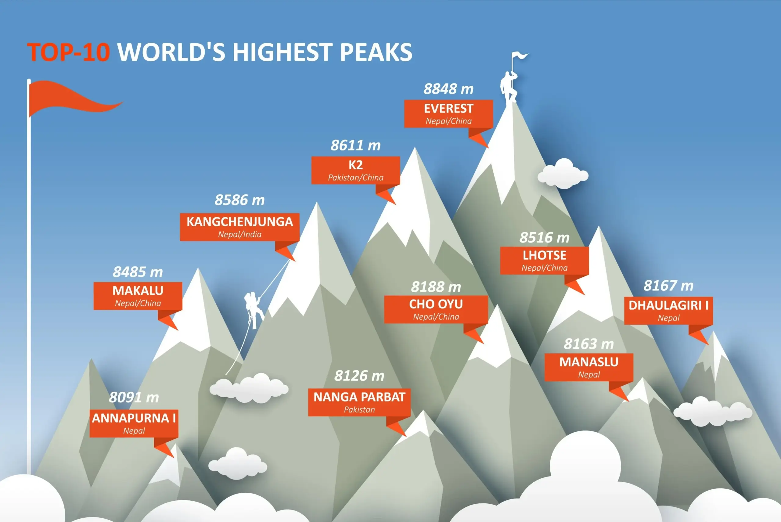
To understand the scale of the summit, it is essential to compare it with other “eight-thousanders.” The following data illustrates the significant elevation gap between the world’s highest peak and its closest rivals:
| Mountain Peak | Height (Meters) | Status | Elevation Gap to Everest |
| Mount Everest | 8,848.86 m | World’s Tallest | 0 m |
| K2 | 8,611 m | 2nd Tallest | 237.86 m |
| Kangchenjunga | 8,586 m | 3rd Tallest | 262.86 m |
| Lhotse | 8,516 m | 4th Tallest | 332.86 m |
Mount Everest Height in Feet
In the United States and the aviation industry, the Mount Everest height in feet is the go-to metric. The number 29,031.7 feet is hard to visualize, but it effectively communicates the scale to an American audience familiar with 10,000 or 14,000-foot peaks in the Rockies or Sierra Nevada.
Comparing to US Peaks
To visualize the scale in feet, consider that Everest’s stature is roughly twice the total elevation of Mount Rainier in Washington. Commercial airliners cruise between 30,000 and 35,000 feet, meaning the summit sits just below the cruising altitude of a 747.
Here is a breakdown of how the Mount Everest height in feet compares to other landmarks:
- Denali: The tallest peak in North America is 20,310 feet, far less than the Mount Everest height in feet.
- Burj Khalifa: The world’s tallest building is 2,717 feet, a fraction of the Mount Everest height in feet.
- Empire State Building: It would take roughly 20 of these stacked to equal the Mount Everest height in feet.
- Grand Canyon: The depth is about 6,000 feet, which fits into the Mount Everest height in feet nearly five times.
- Death Zone Start: This danger zone begins at 26,247 feet, approaching the full Mount Everest height in feet.
- South Col: The final camp sits at 26,000 feet, just 3,000 shy of the Mount Everest height in feet.
- Mt. Whitney: The tallest peak in the lower 48 states is 14,505 feet, roughly half the Mount Everest height in feet.
- Atmospheric Pressure: At the full Mount Everest height in feet, pressure is 33% of sea level.
- Flight Ceiling: Most helicopters cannot hover at the Mount Everest height in feet.
Mount Everest Height in Kilometers
While rarely used in casual conversation, the Mount Everest height km is useful in geological and atmospheric contexts. At approximately 8.85 kilometers, the mountain pierces the troposphere.
Scientific Applications
- Troposphere limit: The summit sits near the upper boundary of the troposphere.
- Atmospheric density: At 8.85 km, the air pressure is about one-third of that at sea level.
- Vertical scale: It helps visualize the crustal thickness of the Himalayas.
Scientists use the Mount Everest height km to model weather patterns.
- The jet stream frequently collides with the summit because this massive landform pierces directly into high-altitude atmospheric currents.
- Geologists monitor the mountain’s elevation in kilometers to precisely track annual uplift rates.
- At approximately 8.85 km, the peak sits at a level comparable to the cruising altitude of many long-haul commercial flights.
- When calculating crustal displacement, the Mount Everest height km provides a vertical baseline.
- The Mount Everest height km is more than twice the depth of the average ocean floor.
- Comparing the Mount Everest height km to the Mariana Trench (11 km deep) shows the Earth’s extremes.
- Ozone monitoring stations rely on data correlated with the Mount Everest height km.
- The precise Mount Everest height km is 8.84886.
- Rounding the Mount Everest height km to 9.0 is common in casual speech but scientifically inaccurate.
- Future tectonic activity could push the Mount Everest height km closer to 8.86.
Never round up the metric height to 9 kilometers in scientific writing; the difference of 150 meters represents a massive variance in atmospheric pressure and survivability.
Mount Everest Height in Miles
For a broad sense of scale, Americans often ask for the Mount Everest height in miles. The calculation is straightforward: 29,031.7 feet divided by 5,280 feet equals approximately 5.5 miles.
Visualizing the Vertical Mile
Imagine a vertical line extending 5.5 miles into the sky. Most people can walk 5.5 miles in about two hours on flat ground. However, achieving that distance vertically involves weeks of acclimatization.
Let’s put the Mount Everest height in miles into perspective:
- Horizontal vs Vertical: A 5k run (3.1 miles) is significantly shorter than the vertical distance to the top of the world.
- Commute: A standard 10-minute highway drive covers the entire vertical distance of the mountain.
- Marathon: A marathon is 26.2 miles, which is nearly five times the Mount Everest height in miles.
- Ocean Depth: The Mariana Trench is roughly 7 miles deep, deeper than the Mount Everest height in miles.
- Stratosphere: The stratosphere begins just above the Mount Everest height in miles.
- Human Endurance: Walking 5.5 miles on a flat track is effortless for most, but covering that distance vertically is a test of survival.
- Visual Limit: On a clear day, you can see distances far greater than the Mount Everest height in miles.
- International Space Station: Orbits at 250 miles, dwarfng the Mount Everest height in miles.
- Commercial Flights: Cruise at roughly 6 to 7 miles high, just above the Mount Everest height in miles.
- Running: An elite runner covers the distance of the Mount Everest height in miles in less than 30 minutes horizontally.
Everest’s official height has changed because different surveys used different reference surfaces and, historically, even disagreed on whether to include the snow cap. This quick explainer walks through why measurements differ and how modern surveying narrowed the uncertainty. It’s a useful visual companion before diving into the geodesy details.
Mount Everest Height Above Sea Level
The concept of “sea level” is the most misunderstood aspect of geodesy. When we discuss the Mount Everest height above sea level, we are referencing a theoretical surface, not the actual ocean.
What Does “Above Sea Level” Mean?
Geographers use a model called the Geoid to determine sea level under landmasses. The Geoid approximates the shape the ocean surface would take under the influence of gravity and Earth’s rotation if other influences such as winds and tides were absent.
Is Everest the furthest point from Earth’s center? Technically, no. Due to the Earth’s equatorial bulge, the summit of Mount Chimborazo in Ecuador sits closer to the stars, despite being ‘shorter’ relative to sea level. Everest wins only when measured by orthometric height—the distance from the geoid.
| Measurement Model | Description & Thresholds | Application to Everest |
| The Geoid | An equipotential surface of Earth’s gravity field (Earth’s “true” shape). | The primary baseline for the 8,848.86 m official height. |
| Reference Ellipsoid | A smooth mathematical model (WGS84). Everest sits ~30–40 meters higher on this scale. | Used by GPS and satellites. It ignores local gravity anomalies. |
| Orthometric Height | Distance measured along a plumb line from the Geoid to the summit. | The standard “above sea level” height used in climber permits and maps. |
| Ellipsoidal Height | The raw distance from the Ellipsoid to the peak. | Raw GPS data before applying geoid undulation corrections (~ -28m in Nepal). |
This comparison highlights that the Mount Everest height above sea level depends heavily on which mathematical model of the Earth is chosen.
Factors Affecting Sea Level Measurements
Gravity is weaker at the equator and stronger at the poles, but local mass concentrations—like the Himalayas—also warp the gravitational field. This complicates the Mount Everest height above sea level because the “zero” point is not consistent.
The Indian Ocean Dipole
The geoid undulates. A survey starting from the Indian Ocean might yield a slightly different Mount Everest height above sea level than one starting from the Yellow Sea in China, simply because “sea level” is different in those two bodies of water. Even slight variations in gravity affect the calculation of Mount Everest height above sea level.
Implications for Climbers and Researchers
For a climber, the Mount Everest height above sea level determines oxygen availability. Every meter counts. The reason the Mount Everest height above sea level is scrutinized is that the summit pushes the physiological limits of the human body.
The Physiological Baseline
If the Mount Everest height above sea level were 500 meters higher, it might be physiologically impossible to climb without supplemental oxygen.
- Oxygen Levels: At the full Mount Everest height above sea level, oxygen is scarce.
- Boiling Point: Water boils at a lower temperature at the Mount Everest height above sea level.
- Acclimatization: The body adapts slowly to the increasing Mount Everest height above sea level.
- Barometric Pressure: This drops drastically as Mount Everest height above sea level increases.
- Safety: Accurate knowledge of Mount Everest height above sea level saves lives.
As high-altitude climber and guide Ed Viesturs—a five-time Everest summiteer (including climbs without supplemental oxygen)—puts it:“Getting to the top is optional. Getting down is mandatory.”
Mount Everest Height in Centimeters
In the world of high-precision geodesy, meters are too blunt. Scientists track the Mount Everest height in cm to monitor tectonic health and earthquake risks.
Converting Meters to Centimeters
The official height of 8,848.86 meters translates to 884,886 centimeters. While measuring to such granularity seems excessive, tracking these minute fluctuations allows geologists to detect tectonic trends that meters simply obscure.
The Math of Movement
A change of 50 centimeters might not matter to a hiker, but it signals massive shifts in the crust. Tracking the Mount Everest height in cm is like taking the pulse of the planet.
- Precision: We measure the Mount Everest height in cm to detect subduction.
- Comparison: The 2005 survey measured the Mount Everest height in cm differently than 2020.
- Equipment: Only modern tools can define the Mount Everest height in cm.
- Data: A database tracks the Mount Everest height in cm over decades.
- Variation: Daily tides in the crust affect the Mount Everest height in cm slightly.
Why Precision Matters
The Mount Everest height in cm changes seasonally. Monsoon snows can add depth, while high winds scour the peak. Furthermore, knowing the exact Mount Everest height in cm helps calibrate satellite instrumentation for the rest of the planet.
Applications of Precise Measurements
When we track the Mount Everest height in cm, we are actually tracking the collision of continents.
A Mini-Checklist for Understanding Precision
- Geological Surveys: Look for changes in the Mount Everest height in cm to predict fault stress.
- GPS Calibration: Uses the peak as a fixed point for triangulation based on Mount Everest height in cm.
- Snow Depth Analysis: Subtracts bedrock height from snow height using Mount Everest height in cm.
- Tectonic Drift: The mountain moves laterally, which correlates with changes in Mount Everest height in cm.
- Equipment Sensitivity: Modern sensors detect variations in Mount Everest height in cm.
- Seismic Monitors: Earthquakes alter the Mount Everest height in cm instantly.
- Isostatic Rebound: Glacial melt affects the Mount Everest height in cm slowly.
- Benchmarks: Surveyors leave markers to track Mount Everest height in cm.
U.S. Geological Survey reporting on geodetic observations after the 2015 Nepal earthquake notes that Everest did not become measurably taller or shorter, but the entire mountain shifted about 3 cm (1.2 in) to the southwest—an example of how earthquakes can change position without changing “height” in a meaningful way. (2015, U.S. Geological Survey)
Mount Everest Height Increase: Causes and Effects
While the Himalayas are geologically young, their growth is not uniform. The current tectonic uplift of ~4mm/year is often offset by seismic subsidence events. For instance, during major earthquakes (like the 2015 Gorkha event), certain sections of the range can actually drop by several centimeters instantly, counteracting decades of slow growth.
The Mount Everest height increase is a continuous process driven by the collision of the Indian and Eurasian tectonic plates.
Tectonic Activity and Earthquake Impact
The primary driver of Mount Everest height increase is the subduction of the Indian plate. It pushes underneath Tibet, lifting the entire range. However, earthquakes can have the opposite effect, causing the crust to settle and momentarily reducing the Mount Everest height increase.
The Growth Rate
Geologists estimate the Mount Everest height increase at approximately 4 millimeters per year. Over a century, this equals nearly half a meter of growth.
- Indian Plate: Moves northward, fueling the Mount Everest height increase.
- Eurasian Plate: Resists the motion, resulting in Mount Everest height increase.
- Seismic Relaxation: Large quakes can negate years of Mount Everest height increase.
- Uplift: The technical term for Mount Everest height increase.
- Compression: Rock layers fold, contributing to Mount Everest height increase.
Climate Change and Glacial Melt
Conversely, climate change impacts the perceived height. Melting glaciers reduce the weight pressing down on the crust, leading to a phenomenon called isostatic rebound. This can theoretically accelerate the Mount Everest height increase as the land rises after the ice melts, though the loss of the snowcap itself lowers the total elevation.
Balancing Forces
- Tectonics: Provide the primary push for Mount Everest height increase.
- Erosion: Acts against Mount Everest height increase.
- Rebound: Adds a secondary factor to Mount Everest height increase.
- Measurement: Satellites track the net Mount Everest height increase.
- Future: Scientists predict a steady Mount Everest height increase for millions of years.
Scientific Studies on Height Variation
Recent studies focus on how the Mount Everest height increase correlates with major seismic events. Researchers are trying to determine if a rapid Mount Everest height increase predicts future earthquakes.
In a peer-reviewed analysis of GPS time series after the 2015 Mw 7.8 Gorkha (Nepal) earthquake, researchers found a broad postseismic deformation field and concluded that near-field motion can be explained by afterslip, while the wider regional pattern likely reflects distributed viscoelastic relaxation—mechanisms that can create short-term vertical and horizontal changes even when the “official height” remains stable. (2020, University of Leeds research team / AGU)
The Significance of Mount Everest’s Height
Why do we obsess over the Mount Everest height? It represents the ultimate physical limit. The cultural and economic gravity of the mountain is as massive as its physical footprint.
Cultural and Historical Importance
To the Sherpa people, the mountain is Chomolungma, “Goddess Mother of the World.” The exact Mount Everest height is less important than its spiritual sanctity. For Westerners, the measurement represents a conquest, a specific number to be overcome.
Respect the local nomenclature; while the height is a scientific fact, the mountain’s name and status hold spiritual weight that transcends measurements.
Mount Everest in Popular Media
From “Into Thin Air” to Hollywood blockbusters, the altitude is the antagonist. The narrative always revolves around the human struggle against the thin air found at the Mount Everest height.
The Narrative of Altitude
Stories focus on the “Death Zone” above 8,000 meters. The media rarely discusses technical specs, preferring the dramatic impact of the Mount Everest height as a barrier to survival.
- Films: Often exaggerate the steepness but accurately depict the Mount Everest height.
- Books: Survivor accounts emphasize the brutality of the Mount Everest height.
- Documentaries: Show the logistical nightmare of conquering the Mount Everest height.
Impact on Tourism and Local Economy
The economy of Nepal relies heavily on the Mount Everest height. If it were 1,000 feet shorter, it would not attract the same high-paying clientele.
- Permit Fees: Charged based on the peak’s status as the ultimate Mount Everest height.
- Expedition Costs: Tens of thousands of dollars per climber to reach the Mount Everest height.
- Local Employment: Porters and guides depend on the allure of the Mount Everest height.
The economic pull of Everest is inseparable from its environmental cost: every season brings crowding, logistics, and waste management challenges. This short immersive piece shows what cleanup looks like on the mountain and why tourism pressure turns into a real operations problem at altitude. It also helps explain why “Everest’s status” drives policy decisions, not just headlines.
Frequently Asked Questions About Mount Everest’s Height
How Often is Mount Everest’s Height Measured?
Major comprehensive surveys happen rarely, typically decades apart. While scientists monitor the Mount Everest height constantly via satellite data, official government re-measurements—like the 2020 joint survey—are infrequent due to the logistical costs and political cooperation required.
Who Conducts the Measurements?
Government bodies usually lead these initiatives. The Survey Department of Nepal and the National Administration of Surveying, Mapping and Geoinformation of China are the primary authorities. They often collaborate with international universities and non-profits to verify the data regarding the Mount Everest height.
What are the Latest Findings?
The latest findings confirm the Mount Everest height is 8,848.86 meters. Interestingly, recent data also suggests the mountain moves northeastwards by about 40cm per decade, meaning the coordinates change even if the vertical elevation remains relatively stable.
Does the Snow Depth Change the Official Height?
Yes, the snow depth varies significantly. The “rock height” is permanent, but the “snow height” can fluctuate by several meters due to monsoon seasons and wind. The official Mount Everest height usually refers to the snow height because that is the visible summit.
Is K2 Getting Closer to Everest in Height?
No, the gap is significant. K2 is 8,611 meters tall. While K2 is growing due to similar tectonic forces, the Mount Everest height maintains a lead of roughly 237 meters. It would take geological epochs for K2 to catch up, assuming erosion rates remain constant.
Conclusion
The Mount Everest height is more than a statistic; it is a testament to the dynamic nature of our planet. From the shifting tectonic plates causing a steady Mount Everest height increase to the precise calculations of the Mount Everest height in cm, the science behind the summit is evolving. We have explored how the Mount Everest height in feet (29,031.7) serves as a benchmark for aviation and how the Mount Everest height km (8.85) defines the atmospheric limits of human survival. We also looked at the confusion surrounding the Mount Everest height in miles and the technical nuance of calculating the Mount Everest height above sea level.
Understanding these metrics gives you a deeper appreciation for the Earth’s geology. Whether you track the Mount Everest height in meters for accuracy or visualize the Mount Everest height in miles for scale, the key takeaway is that the Earth is active, living, and constantly changing.
If you are planning a high-altitude trek or just want to keep your geography knowledge sharp, I have prepared a resource to help you prepare.

This document breaks down the essential equipment and physical milestones required for trekking in regions with extreme elevation. It is not just about having the right boots; it is about understanding how altitude affects your body and how to mitigate those risks effectively.
What surprises you most about the measurement history of Everest? Do you think the rock height or the snow height should be the standard? Drop a comment below to start the discussion!
Sources
- 2021 — Survey Department, Government of Nepal (Kathmandu) — Measurement of Height of Mt. Sagarmatha
- 2015 — U.S. Geological Survey (USGS) — M7.8 Nepal Earthquake, 2015 – A Small Push to Mt. Everest
- 2020 — University of Leeds research team / AGU (Journal of Geophysical Research: Solid Earth) — Postseismic Deformation Following the 2015 Mw7.8 Gorkha (Nepal) Earthquake: New GPS Data, Kinematic and Dynamic Models, and the Roles of Afterslip and Viscoelastic Relaxation
- Viesturs, Ed (1997), PBS NOVA — NOVA Online | Alive on Everest | Climbing/Living