Determining Mount Everest in which country is located is often the very first hurdle for aspiring trekkers and geography enthusiasts alike. Many travelers assume the peak sits entirely within a single nation, leading to visa confusion and logistical headaches. If a visitor books a flight to Kathmandu hoping to see the North Face, they are in for a surprise. Understanding the specific borders is crucial for anyone looking to visit, climb, or simply admire the roof of the world. This knowledge dictates which permits are required, the total cost of the trip, and which airport serves as the entry point. Failing to grasp the geography can result in lost deposits and ruined plans. By the end of this guide, readers will know exactly how to navigate the region and choose the right side for their adventure.
The primary benefit of mastering this geographical detail is saving time and money while ensuring a safe journey. Knowing Mount Everest in which country is situated allows adventurers to pick the route that matches their physical fitness and budget.
Geographical Location of Mount Everest
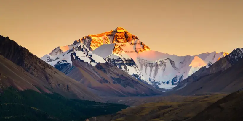
Pinpointing the exact coordinates of the highest peak on Earth is not as simple as dropping a pin on a digital map. The formation does not sit neatly inside one territory; instead, it acts as a colossal, natural wall between two major geopolitical powers. This massive geological structure is part of the Greater Himalayas, a range that stretches across several nations, but the summit has a specific address.
Mount Everest: Situated in Two Countries
The apex marks the precise international boundary between Nepal to the south and China (specifically the Tibet Autonomous Region) to the north. It is not owned solely by either nation. When a climber stands on the very top, one foot rests in Nepal and the other in China. This unique positioning means the mountain has two distinct faces, two main base camps, and two very different cultures surrounding it.
For an American traveler named Mike, this reality hit home when he planned a photography tour. He desired the iconic “golden hour” shot of the North Face but booked a trek to the southern Base Camp. Upon arrival, the photographer realized the view he wanted was physically blocked by the Nuptse ridge and required a Chinese visa he didn’t have.
Expert mountaineer Lakpa Rita often explains that while the summit is shared, the experience of getting there is worlds apart. The terrain dictates the difficulty; the southern approach is a hike through valleys, while the northern route involves a drive across a high plateau.
Understanding the Nepal-China Border
The dividing line runs directly across the summit point. This boundary was officially settled in a border treaty signed in 1961, resolving disputes about where the rock formation truly belonged. The “Line of Control” here is distinct because it is defined by the highest points of the ridge.
Geological Borders vs. Political Borders
Geologically, the massif is a single block of limestone and marble pushed up by tectonic plates. Politically, however, access is strictly controlled. You cannot simply walk from the south side to the north. Crossing the apex from Nepal into Tibet or vice versa is technically possible for elite alpinists, but it is strictly illegal without rare, specialized dual permits.
Mount Everest’s Location by Country
Choosing which side to visit depends entirely on what kind of experience a tourist wants. The infrastructure, legal requirements, and views differ drastically depending on the side of the border. When asking Mount Everest in which country offers the best experience, the answer depends on physical fitness and budget.
Mount Everest in Nepal
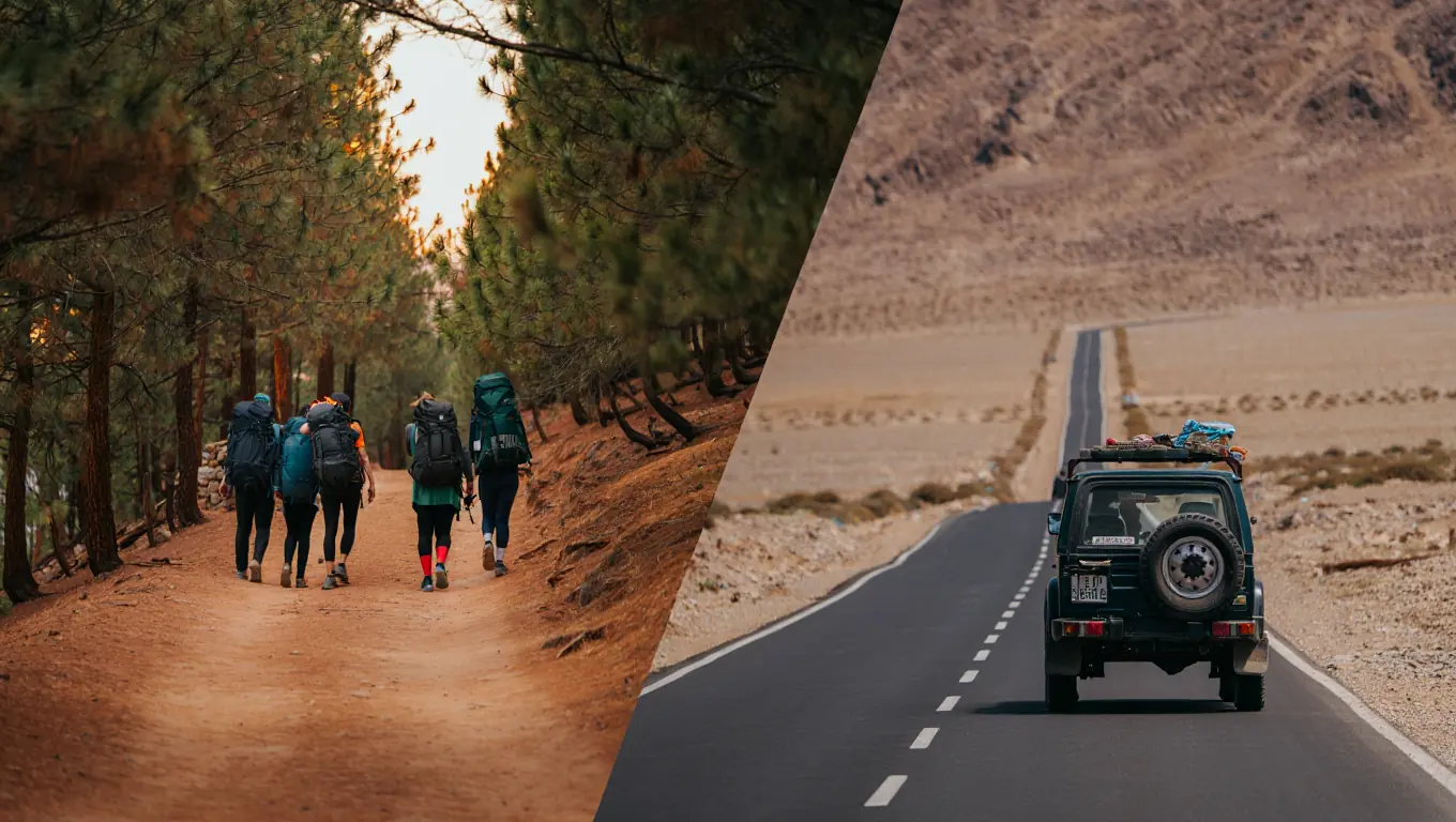
The Nepalese sector is the most famous and most frequented by Western tourists. Located in the Sagarmatha National Park, this area offers the classic trekking experience. Here, there are no roads to Base Camp; visitors must hike for over a week to reach the foot of the giant.
- Accessibility: Requires a flight to Lukla and a multi-day trek.
- Culture: Deeply immersed in Sherpa tradition and Buddhism.
- Crowds: Generally busier with hikers and alpinists in the spring and autumn.
- Scenery: Lush pine forests transitioning to alpine desert and glaciers.
- Medical Support: Helicopter rescue is readily available.
Mount Everest in China
On the northern side, the peak is known as Qomolangma. This face is located in Tingri County of the Tibet Autonomous Region. The terrain here is stark, arid, and wind-swept. Unlike the southern slopes, a paved road leads all the way to the Chinese Base Camp, making it accessible to those who cannot walk for days.
How to Decide Which Country to Visit
If a vacationer is unsure which side fits their needs, following a logical selection process helps.
Always check the current visa regulations for both Nepal and China before booking flights.
- Assess Physical Ability: If hiking 6-8 hours a day for two weeks sounds impossible, choose the China side where vehicles can drive up to 5,200 meters.
- Determine Budget: The Nepal trek can be done economically by hiring a porter-guide, whereas the Tibet route requires an organized tour with a government guide, which is often more expensive for solo travelers.
- Check Political Stability: Occasionally, Tibet closes to foreigners with little notice. Nepal is generally more open and predictable regarding tourist visas.
- Choose the View: For a full, unobstructed look at the summit from base camp, the North Face is superior. The South Base Camp is actually so close to the wall that the top is hidden by neighboring peaks.
What Continent is Mount Everest In?
Zooming out from national borders, the formation anchors the geography of an entire landmass. It is the crown jewel of Asia. The sheer size of the Himalayas influences the weather patterns for billions of people living on the Asian continent.
Mount Everest on the Asian Continent
The summit sits on the edge of the Indian and Eurasian tectonic plates. The collision of these plates, which began nearly 50 million years ago, continues to push the Himalayas upward. This makes Asia the home of all fourteen of the world’s peaks that exceed 8,000 meters.
Significance of the Himalayas in Asia
The Himalayas are often called the “Water Towers of Asia.” The glaciers on the peak and surrounding mountains feed major river systems like the Ganges, Indus, and Brahmaputra. These rivers provide liquid for drinking, agriculture, and hydroelectric power for millions of people in India, Nepal, and Bangladesh.
The question of Mount Everest in which country is accessible involves comparing logistics.
| Feature | South Base Camp (Nepal) | North Base Camp (China/Tibet) |
| Altitude | 5,364 meters (17,598 ft) | 5,150 meters (16,900 ft) |
| Access Method | Trekking (8-12 days) | Vehicle/Road |
| View of Summit | Obscured by Nuptse/Lhotse | Clear, unobstructed view |
| Permit Difficulty | Moderate (TIMS & Park Fee) | High (Tibet Travel Permit required) |
| Best Season | Oct-Nov, Mar-May | Apr-May, Sept-Oct |
This comparison shows that while Nepal offers the physical challenge of the hike, China offers visual grandeur with easier access.
According to peer-reviewed research published in npj Climate and Atmospheric Science, the South Col Glacier is thinning so quickly that ice which took roughly two millennia to form could be lost in a matter of decades—about 80 times faster than its formation rate (2022, University of Maine-led research team).
Cultural and Historical Significance of Mount Everest
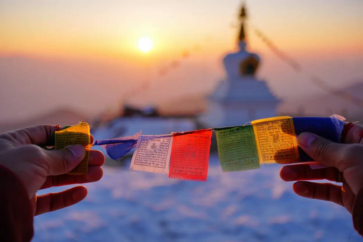
The massif is not just rock and ice; it is a sacred entity. For the residents living in its shadow, the peak has a spiritual personality. Understanding this cultural depth prevents tourists from committing faux pas and helps them appreciate the region beyond just the physical challenge. The answer to Mount Everest in which country holds the richest history often leads to the Sherpa people of the south.
Sherpa Culture and Mount Everest
The Sherpa community, an ethnic group native to the most mountainous regions of Nepal, revere the summit as “Sagarmatha,” meaning “Goddess of the Sky.” They believe the formation is the abode of Miyolangsangma, a Buddhist goddess of inexhaustible giving.
Cultural Etiquette Checklist
When visiting the region, observing local customs is mandatory to show respect.
- Walk Clockwise: Always pass mani stones (prayer stones) and stupas on the left side, keeping the monument to your right.
- Dress Modestly: Avoid revealing clothing in villages and monasteries.
- Ask Permission: Always ask before taking photos of monks or locals.
- Do Not Step on Hearths: The kitchen fire is sacred; never throw trash into it or step over it.
- Respect the Wildlife: Harm no living thing; hunting and fishing are strictly forbidden in the Khumbu Valley.
Historical Expeditions and Achievements
The history of climbing is filled with triumphs and tragedies that occurred on both sides of the border. Early British expeditions in the 1920s focused on the Tibetan territory because Nepal was closed to foreigners at the time. It wasn’t until the 1950s, when the southern nation opened up and the northern region closed due to political changes, that the focus shifted.
The summit of Mount Everest is not just a physical point, but a meeting place of history and ambition.
“My initial feelings were of relief … there was no disguising his infectious grin of pure delight.” (Sir Edmund Hillary)
According to a fieldwork-based academic study of Nepal’s Khumbu region, Everest-driven trekking and climbing tourism has reshaped local livelihoods and economic activities—accelerating a shift away from traditional agro-pastoral work toward tourism occupations (2020, Tribhuvan University).
The First Ascent
Edmund Hillary of New Zealand and Tenzing Norgay Sherpa of Nepal were the first to stand on the top on May 29, 1953. They climbed from the southern slopes. This achievement put the nation on the global map and launched the modern tourism industry that sustains the country today.
Respect local customs by walking clockwise around religious monuments like stupas and mani stones.
Unique Features of Mount Everest
The physical characteristics of the giant define the challenge it presents. It is an environment hostile to human life, yet thousands flock there annually. Knowing these features helps a traveler understand why the specific Mount Everest in which country context dictates the climbing season and strategy.
The Highest Peak in the World
The official elevation of the massif has been a subject of debate for decades. Tectonic activity and earthquakes can slightly alter the height.
The Official Height
For years, Nepal recognized 8,848 meters, while China measured slightly less, excluding the snow cap. In a historic display of diplomacy, the two governments jointly announced a new official height in December 2020. The peak stands at 8,848.86 meters (29,031.7 feet).
Climate and Weather Conditions
The weather at the pinnacle is dictated by the jet stream. For most of the year, hurricane-force winds scour the top, making it unclimbable. Temperatures can drop as low as -60°C (-76°F).
The weather window for summiting is incredibly narrow, usually occurring only in May.
The Summit Window
There is a brief period, usually in mid-to-late May, when the jet stream moves north, and the winds calm down. This is when the “traffic jams” of climbers occur. The weather patterns differ slightly depending on Mount Everest in which country you are climbing from; the north face is generally colder and windier, while the south side receives more snow precipitation.
How to Visit Mount Everest
Visiting the region requires distinct paperwork and preparation depending on the chosen entry point. The logistics for Nepal are vastly different from those for China. Knowing Mount Everest in which country you intend to enter is the first step in the planning phase.
Traveling to the Everest Base Camp
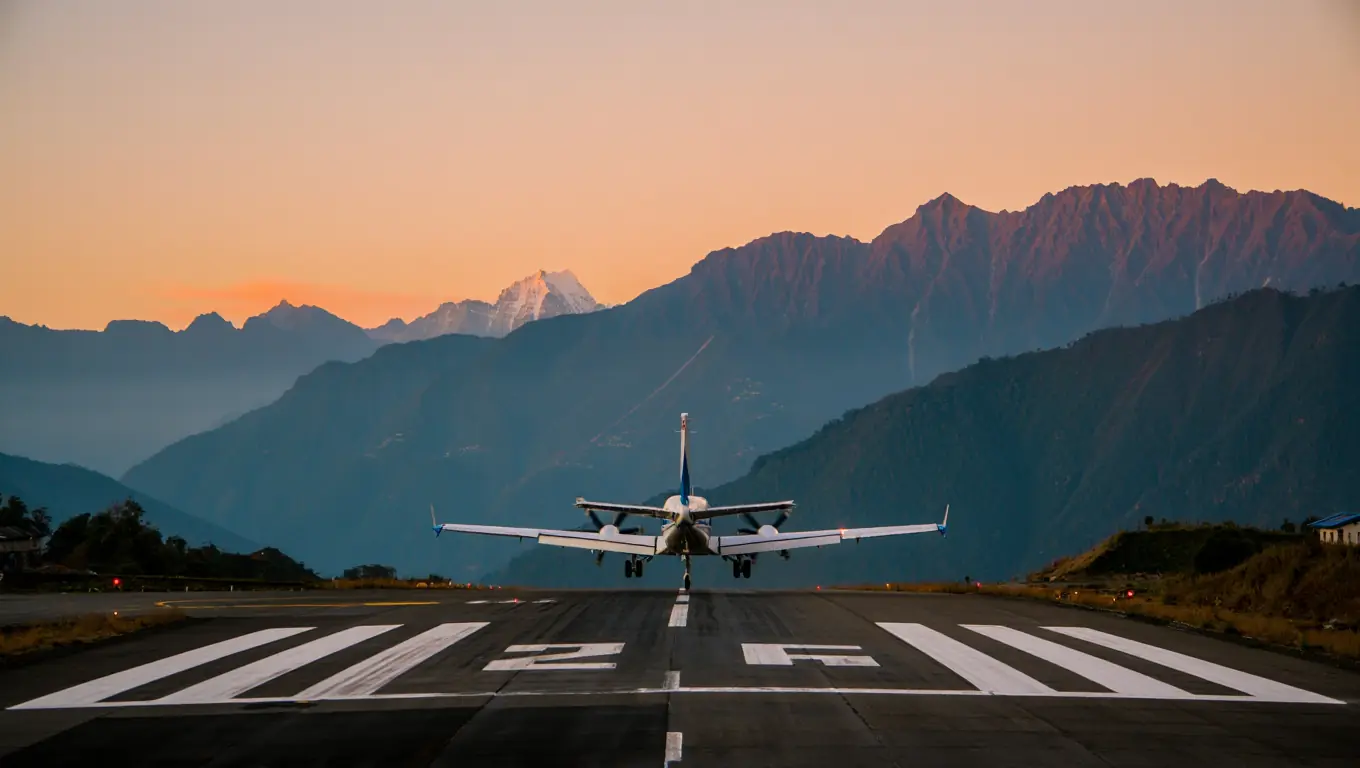
For the Nepal side (South Base Camp), travelers fly into Kathmandu. From there, they take a small twin-otter plane to Tenzing-Hillary Airport in Lukla. This flight is famously thrilling. From Lukla, the trek takes about 12 days round-trip.
For the China side (North Base Camp), tourists usually fly into Lhasa or Chengdu. They then take a combination of trains and private vehicles across the Tibetan plateau. This journey involves a rapid gain in altitude, so acclimatization stops in cities like Shigatse are essential.
Permits and Regulations for Climbers
Bureaucracy is the first mountain to climb.
Nepal Requirements
To trek to Base Camp, a hiker needs the Sagarmatha National Park entry permit and the Khumbu Pasang Lhamu Rural Municipality entrance permit. A TIMS (Trekkers’ Information Management Systems) card is no longer required for this specific region as of recent updates, having been replaced by the local pass.
China Requirements
Visiting the North Face requires a Chinese Group Visa (if entering from Nepal) or a standard Chinese tourist visa (if entering from mainland China), plus a specific Tibet Travel Permit. Independent travel is not allowed; visitors must be part of an organized tour with a licensed guide. Identifying Mount Everest in which country serves as your entry point determines whether you need a hiking backpack or a comfortable seat in a van.
Interesting Facts About Mount Everest
Beyond the height and the borders, the formation holds strange and fascinating secrets. These facts often surprise people who only know the peak by its altitude. The trivia often varies based on Mount Everest in which country the stories originate from.
Lesser-Known Facts About Everest
The mountain is actually growing. The Indian tectonic plate continues to push under the Eurasian plate, lifting the Himalayas by approximately 4 millimeters every year. Conversely, earthquakes can cause the rock to shrink or shift slightly.
Another strange phenomenon is the “Rainbow Valley.” This is a grim area near the summit on the northern side, filled with the colorful jackets of fallen climbers whose bodies cannot be recovered due to the extreme altitude. It serves as a stark reminder of the danger.
Impact of Tourism on the Region
The influx of visitors has brought wealth but also waste. The trail to the Nepal Base Camp is sometimes referred to as the “tissue paper trail.”
The Waste Problem
Both nations have implemented strict rules. Climbers are now often required to bring back their own waste (including human waste) from the higher camps. The “carry-out” rule is strictly enforced to protect the fragile ecosystem. When researching Mount Everest in which country creates more pollution, the answer is usually the Nepal side simply due to the higher volume of foot traffic.
FAQ
Why do people think Everest is in India?
Many people mistakenly associate the Himalayas strictly with India because the range spans the Indian border. While India has massive Himalayan peaks like Kanchenjunga, Everest itself is located further north, sandwiched between Nepal and China, not India.
Is it cheaper to see Everest from Nepal or China?
Generally, the Nepal Base Camp trek is cheaper for budget travelers because you can go with just a porter or independently (though regulations on solo trekking are tightening). A trip to the Tibet side requires an organized tour agency, private transport, and a government guide, which drives up the base cost.
What currency should I bring for the trip?
If you are on the south side, you need Nepalese Rupees (NPR). While US dollars are accepted in Kathmandu, small tea houses on the trek prefer rupees. On the north side, you must use Chinese Yuan (RMB).
Do I need oxygen to visit Base Camp?
No, supplemental oxygen is not required for visiting Base Camp on either side (approx 5,300m). However, the air is thin, with only about 50% of the oxygen available at sea level, so altitude sickness is a very real risk that requires slow acclimatization.
Can I see Everest without trekking?
Yes. On the Tibet (China) side, you can drive all the way to the Rongbuk Monastery near Base Camp. In Nepal, you can take a “mountain flight” from Kathmandu that flies past the peak, or take a helicopter tour directly to Base Camp and back in a single morning.
Watch this video to visualize the geography:
This National Geographic video helps you picture what “base camp” actually looks like and why logistics differ so much by approach. As you watch, pay attention to how access, altitude, and terrain shape the experience on the Nepal side versus the Tibet side. It’s a fast way to connect the border explanation to real on-the-ground conditions.
Conclusion
Determining Mount Everest in which country is best for a visit ultimately comes down to personal preference between physical adventure and visual accessibility. The massif stands as a bridge between the lush valleys of Nepal and the high arid plateaus of China. It offers two distinct worlds, separated only by a ridge of ice and rock.
Whether a traveler chooses to lace up boots for the dust of the Khumbu Valley or drive across the vast Tibetan plains, the mountain commands respect. The geography is not just a line on a map; it defines the culture, the climate, and the challenge.
Before booking any tickets, review the current entry requirements for both nations, as rules change frequently. Start walking or hitting the gym now to prepare the body for the altitude. The roof of the world is waiting.
Sources
- (2022, University of Maine-led research team) Mt. Everest’s highest glacier is a sentinel for accelerating ice loss
- (2020, Tribhuvan University) Tourism and Transformation: Changing Livelihood Practices of Mountain Dwellers
- Edmund Hillary (1953), The Ascent of Everest